Posted by: sunnyharvy | April 7, 2015

Time for a Little Break

HaRVy is currently comfortably parked on an RV pad at the home of our friends Rick and Leslie in Minden, NV. Thank you Rick and Leslie for making us feel so welcome. Your warm hospitality is greatly appreciated, plus it’s great to see you both again!

We are taking some time off here to get caught up on various projects and business. Some of these tasks can be difficult while always on the move. I am also working on getting rid of a bad cold. Nicer to do that with a home-base than in campgrounds. The view from their tub (below) isn’t quite as good as the one from the hot springs in my previous post, but it will certainly suffice.

MindenByiPad0157

The weather has turned cold again after weeks of warmer than usual temps and sunny skies. Currently we can see snow falling in the nearby mountains. Hopefully the forecast calling for the warmth to return in a few days is correct, as we plan to continue our journey northward soon. Now let me get caught up on the last couple of days travel before arriving here.

Crestview0111

Free camping on beautiful forested BLM land.

Crestview0115

Our 4th uninvited passenger. Momentarily stunned after being caught and released.

JuneLake0120

Quiet and peaceful June Lake on the picturesque June Lake Loop drive we enjoyed.

JuneLake0124

Our last stop of interest was at Mono Lake (below), a large, shallow saline soda lake formed at least 760,000 years ago. Currently, the primary draw for tourists are the ” tufa towers,” calcium-carbonate spires and knobs formed by interaction of freshwater springs and alkaline lake water.

MonoLake0134

MonoLake0136

MonoLake0145

MonoLake0151

MonoLake0152


Posted by: sunnyharvy | April 6, 2015

The Hunt for Hot Springs

When one travels through areas exhibiting evidence of previous volcanic activity, you just know there has to be some hot springs around. The trick is to find them! Thanks to Marianne Edwards’ excellent Shunpiker’s Guide to California Boondocking The Desert and Eastern Sierrawe had explicit directions to some of the best in the area.

KeoughHotSprings0042

At Keogh Hot Springs there are several pools to choose from. Since they are not far off the road, these pools can be busy, so we opted to wear swimsuits (sorry Jim R).

KeoughHotSprings0046

The hot mineral water helped Al’s bruised muscles relax a bit.

KeoughHotSprings0050

Felt pretty good to me too!

Later that afternoon a few miles north of Bishop, CA, we spent a couple of hours touring the Laws Railroad Museum. Laws is not just another train museum.  Located on the site of the Laws narrow-gauge railroad station and rail yard, the land, 1883 depot and other buildings, and the last train, were donated to the City of Bishop by the Southern Pacific Railroad in 1960. At the museum they are preserving and sharing the history of the Owens Valley and Eastern Sierra on 11 acres of open air exhibits.

LawsRRMuseum0058

The original post office for the town of Laws.

LawsRRMuseum0061

A track-side water well plus oil and water tanks.

LawsRRMuseum0062

LawsRRMuseum0084

The original 1883 Laws depot.

LawsRRMuseum0088

I thought it was interesting that the sign on the depot includes my hometown of Glendale 270 miles away.

LawsRRMuseum0085

Engine #9 and a few restored narrow-gauge cars.

LawsRRMuseum0064

1883 train turntable, tired and no longer turning, but interesting to see nonetheless.

LawsRRMuseum0074

LawsRRMuseum0077

A horse-drawn oil tanker truck. Ironic?

LawsRRMuseum0078

See explanation below.

LawsRRMuseum0081

LawsRRMuseum0071

Bishop0091

If this sign is correct, why has it taken us over 22,000 miles to get here?

After a night camped alongside the Owens River at the Pleasant Valley County Campground, we were off in search of more hot springs.

CaliforniaAquaduct0093

No hot springs here, but a good look at a segment of the 700-mile long California Aqueduct that feeds water to Southern California.

HilltopHotSprings0097

They say there’s a hot springs pool out there somewhere.

HilltopHotSprings0099

There it is… and what a view!

HilltopHotSprings0102

After some time alone, we were joined by a couple from Portugal and two young men from France.

Posted by: sunnyharvy | April 3, 2015

More Adventure Along Route 395

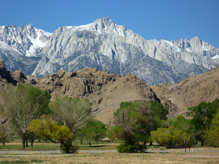
Inyo County touts itself as “The Other Side of California” and I can’t think of a better, or more accurate marketing slogan. Wish I had come up it! This “other side” is different in many ways than those west of the Sierra Nevada Mountains. For one thing, it’s much more affordable. From campsites to mansions, real estate costs a fraction of what it does closer to the coast. Of course the scenery is very different since much of the acreage is desert – both low and high varieties. Plus, the people seem much more relaxed and friendly.

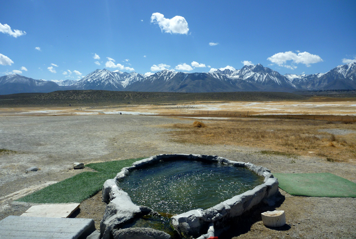
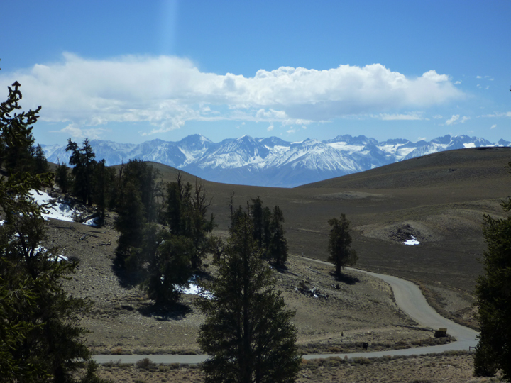
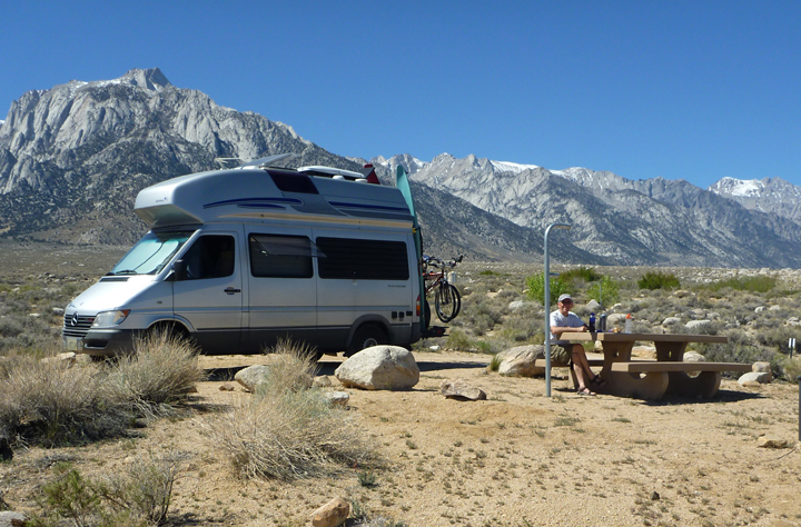
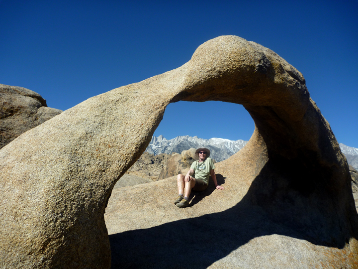
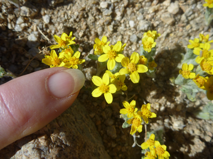
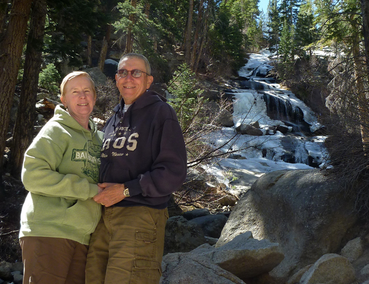
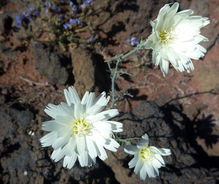
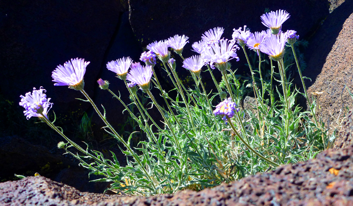
Route 395 is the primary north-south highway east of the mountains. Most driving this route are on it to get somewhere else, but there are a lot of reasons to stop and smell the wildflowers. I showed you a couple in my previous post, here are a few more.

In 1942, the United States government ordered more than 110,000 men, women, and children to leave their homes and detained them in remote, military-style camps. Manzanar War Relocation Center was one of ten camps where Japanese American citizens and resident Japanese aliens were interned during World War II. Manzanar interned over 10,000 people behind barbed wire with no due process of law. Some internees found it ironic that the nearest town, six miles to the north, is named Independence.

Manzanar0926

Guard tower.

Here we learned how resourceful the internees were in making their confinement feel like a community. They steadfastly attempted to make the best of a bad situation. They established churches, temples, and boys and girls clubs. They developed sports, music, dance, and other recreational programs; built gardens and ponds; and published a newspaper, the Manzanar Free Press.

Manzanar0928

 Any combination of eight individuals was allotted a 20-by-25-foot room in a barrack such as the one above. An oil stove, a single hanging light bulb, cots, blankets, and mattresses filled with straw were the only furnishings provided.

Manzanar0931

Each block consisted of 14 barracks, shared men’s and women’s toilets and showers, a laundry room, and a mess hall. Learn more here.

FishHatchery0937

The Mt. Whitney Fish Hatchery was built in 1915 and is a great stop for anyone who appreciates history and how the Easter Sierra helped to become one of America’s greatest outdoor sporting areas. Nice place to have a picnic too.

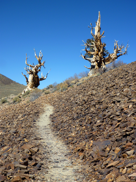
I’ve been curious about the Ancient Bristlecone Pine Forest for some time, but never imagined we’d be able to visit on this trip since the road to it rarely opens before mid-May. I got very excited when Ranger Tim at the Interagency Visitor Center in Lone Pine told us the road had opened a few days prior to our arrival! Once again we benefited from California’s lack of snow.

Bristlecone0982
BristleconePineWithiPad0139

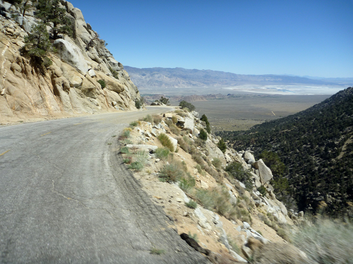
The route is known for its pristine scenery and grand vistas of the White and Sierra mountains. The road is well paved, but narrow and very twisty with sheer drop-offs.  Definitely a road to take it easy on.  We must be determined to cure Al’s acrophobia, right? The rare Bristlecone Pine forest is at the end of the paved portion of the road, where we found tourists forming snowballs with what little snow was left on the ground. 

Bristlecone0031

Bristlecone0976

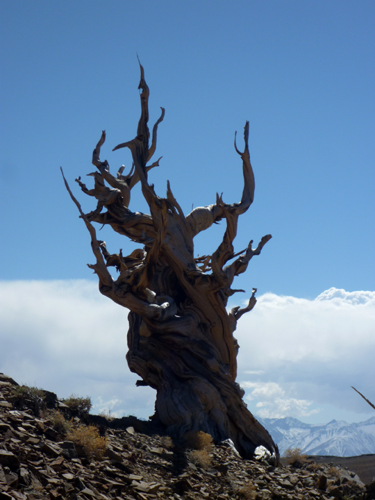
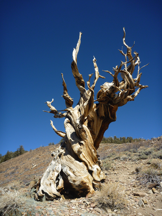
The trees of the Ancient Bristlecone Pine Forest are the oldest recorded living things on earth. A millennium older than the Giant Sequoia trees in the nearby Sierra, many are well over 2,000 years old and at least one has been dated at over 5,000! These trees were young and growing at the time stone axes were being used in Europe and the Great Pyramid of Khufu (Cheops) was being built.

Bristlecone0023

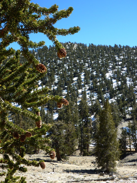
Bristlecone pines (Pinus longaeva & aristata) grow at elevations of 9,000 to over 11,000 feet. The oldest trees grow on outcrops of dolomite, an alkaline calcareous, low nutrient soil. Only on the alkaline dolomite will you find pure, relatively dense stands of bristlecone pine.

Bristlecone0017

Bristlecone0009

I think they look a little like they are dancing.

Bristlecone0008

Bristlecone0003

Bristlecone0002

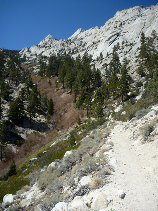
Hiking the Discovery Trail.

Bristlecone0990

After his extensive analysis of collected samples that verified the age of these trees, Edmund Schulman wrote: “The capacity of these trees to live so fantastically long may, when we come to understand it fully, perhaps serve as a guidepost on the road to understanding of longevity in general.” Learn more here.

Bristlecone0986

Getting up close and personal with the old wood.

Bristlecone0030

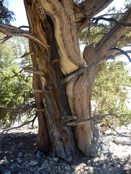
These two seem to be in a very tight embrace.

Bristlecone0024

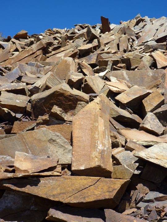
Ice cracked red dolomite.

Bristlecone0020

That evening we camped a few miles down the hill at Grandview Campground. The late night temperature dropped into the 20’s, but our comforter and haRVy’s diesel heater kept us warm.

GrandviewCG0038

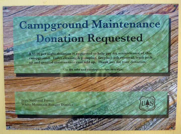
Here’s a sign we’d like to see at more campgrounds (Donation $5 per night). This was the first we’d observed. It would be great to pay what you feel a campsite is worth, as many are drastically overpriced.

GrandviewCG0037

And here’s a sign (at same campground) we would rather NOT see too often.

Quote I liked from a Yelp review: Hunched-over, with gnarly and crooked limbs and peeling bark, the Bristlecone Pines of the California White Mountains look like the little old ladies of the plant kingdom. Despite their distinction as the oldest living things on earth, they are osteoporosis-free, and as hard as the dolomite rock they grow in. Knock on wood, and you might just bruise your knuckles.

Posted by: sunnyharvy | April 3, 2015

The Other Side of California

Upon approach to Lone Pine, CA, named for a towering pine that stood over the town in the 1800s, views of Mt. Whitney’s 14,496-foot summit now steal the show. Beyond Lone Pine’s city center is the Whitney Portal Trail that leads to the summit of Mt. Whitney, the tallest mountain in the continental U.S.

LonePine0809Our first glimpse of Mt. Whitney (far right) from the Visitor Center.

We had heard many people rave about the boondocking options in this area, but we needed to empty our tanks, so we headed over to the BLM’s Tuttle Creek Campground to dump out. Once we spotted the site shown below and realized it would only cost $2.50/night with our senior pass, we didn’t see any reason spend time hunting for something that may or may not be better. There weren’t very many other campers here anyway.

LonePine0814

You can’t beat this spot for just $2.50 a night! The peak of Mt. Whitney shows just above our kayak bows.

It was pretty hot by the time we’d finished lunch, so rather than hike around in the afternoon heat, we headed over to the Lone Pine Film History Museum. Therein we found a fascinating collection that tells the story of filming in the area in and around Lone Pine, from the early days of the Round Up (1920) to Gunga Din (1930) to the modern blockbusters of today such as Iron Man. Literally hundreds of films, commercials and television shows have been filmed here.  The Alabama Hills, which lie just behind town, have portrayed the wilds of the American West, the valleys of the Himalayas, and the Arabian desert. The complete film list can be viewed here.

LonePine0818

Here I am with my buddy William Boyd, aka Hopalong Cassidy and his horse.

LonePine0819

Al with the Duke.

Do you know how John Wayne got that nickname? A local fireman at the station on his route to school in Glendale started calling him “Little Duke” because he never went anywhere without his huge Airedale Terrier, Duke. He preferred “Duke” to “Marion”, and the name stuck for the rest of his life.

LonePine0826

Morning view from haRVy’s upstairs bedroom window.

Before the heat set-in the next morning, we took the Mobius Arch hike in the nearby Alabama Hills. The rounded contours of the Alabamas contrast with the sharp ridges of the Sierra Nevada to the west even though they are the same age. The difference in wear can be accounted for by different patterns of erosion.

LonePine0846

LonePine0845

LonePine0848

LonePine0849

LonePine0858

Mt. Whitney and yours truly through the Mobius Arch.

LonePine0860

Looking in the opposite direction.

LonePine0862

Tiny wildflowers along the trail.

A dramatic change of scenery and temperature greeted us at the end of the Whitney-Portal Road, a short but spectacular drive that takes you about halfway up Mount Whitney. I’m not sure it deserves its listing on dangerousroads.org, but the 13-mile road is narrow, steep and winding, with dramatic switchbacks.  The road has a film history, too. The steep, sharp switchbacks were prominent in scenes in the Lucille Ball and Desi Arnaz film The Long, Long Trailer, in which Luci surreptitiously fills a travel trailer with her rock collection until it’s too heavy to ascend the grade. The road is also featured in the 1941 classic, High Sierra, starring Humphrey Bogart. HaRVy had no trouble ascending, but the descent was pretty tough on his brakes. 

LonePine0919

Normally this road doesn’t open until May, but you can see that snow was no problem as early as March 27th. Unfortunately for California, this year’s snowfall is a record low at just 6% of average.

LonePine0914

We hiked up the trail to the summit of Mt. Whitney for a mile or so. The entire ascent is 6,000 feet in 22 miles.

LonePine0913

LonePine0912

LonePine0894

LonePine0876

Posted by: sunnyharvy | March 26, 2015

Where the Volcanoes Blew

California’s desert areas received just enough rain this winter to awaken long dormant flower seeds. Some areas are literally carpeted with color. Difficult to photograph, but lovely to observe as we drive along. Here is a small sample, I hope to capture more shots soon.

FossilFalls0761

Our first two nights east of the Sierras along Route 395 was at Fossil Falls BLM Campground. With our National Parks Senior Pass the cost was a whopping $3/night. Gotta love that! There are about a dozen sites here all of which are very private and quiet. Not that we have many neighbors this time of year anyway. There is no shade, however, so we are glad the weather is mild (except for the wind – more on that later).

The highlight here is a very short hike to the unique geological feature that is Fossil Falls. During the last ice age, glaciers formed in the Sierra Nevada. Meltwater from the glaciers pooled into large lakes, including Owens Lake and the Owens River. The river’s course was diverted several times by volcanic activity. The falls were formed when the river was forced to divert its course over a basalt flow, polishing and reshaping the rock into a variety of unique shapes and forms.

FossilFalls0775

 From top of falls.

FossilFalls0772

Across the chasm. FossilFalls0769

This view looks back at where the falls flowed down into the canyon.

FossilFalls0779

This red cinder cone, visible to the north of the falls (and our campsite), is the result of the violent ejection of trapped gases and molten material into the air from a vent in the earth’s crust. Cooling quickly when exposed to the air, the molten material formed a porous rock known as scoria, which built up around the original vent forming this cone-shaped hill.

FossilFalls0780

As we hike around lots of volcanic rock formations, we are compelled to think about the violent eruptions that occurred in this area for thousands of years. The loudest sounds now are created by birds and the wind. Speaking of which, somewhat high wind velocity kept us in our campsite for an extra day of forced relaxation in very pleasant surroundings.

FossilFalls0788

There is water at this campground, but you have to work hard to get it.

I promised to get more wildflower photos. Here’s what I captured. Still not a great representation, so I will keep trying. Fun to do anyway. They seem so determined to grow despite the difficult conditions.

FossilFalls0783

FossilFalls0792

FossilFalls0786

FossilFalls0796

FossilFalls0800

You gotta love springtime, wherever you are!

Posted by: sunnyharvy | March 25, 2015

Back Onboard

We enjoyed our respite with my brother and his wife at their comfortable home in Camarillo, CA. Thank you both for your gracious hospitality. I hope we didn’t take too much advantage. We stayed a little longer than anticipated (again), due to a little incident with gravity Al experienced while riding his bike. It’s been nearly two weeks now and his injuries are healing well. We are both glad to be onboard haRVy and traveling once again. I guess this lifestyle suits us as neither of us are in any rush to be house-bound again.

Our next leg will take us north on Route 395 to the east of the Sierra Nevada Mountains. This territory is about as different from what we experienced along the coast over the past couple of months as one can imagine. Neither of us really favor the desert, but we wanted to see new things and visit friends up the road in Minden, NV. Our first stop was for a  lunch break in Fillmore, CA, where we found an array of old railroad locomotives, cars, and even a railway turntable.

Fillmore0705

Fillmore0706

Fillmore0708

After a quiet overnight in Rosamond with Boondocker’s Welcome hosts Randy and Lois, we were off to another interesting lunch stop in Randsburg, known as a “Living Ghost Town.” It’s pretty cool – not all “done up pretty” for tourists like some similar towns out this way. We almost felt like we’d landed in a different time. Actually, it’s not a ghost town at all: there are still about 80 inhabitants living here, mostly retired plus a few originals. The buildings have been left pretty well “as they were” and many along Main Street, dating circa 1903, still stand. The original structures are now businesses including several saloons, restaurants, a general store with an original soda fountain, antique stores, and a small historical museum. They do cater to tourists, but mostly on weekends. Our visit occurred on a Tuesday, so most everything was closed. I wasn’t disappointed though, as there were photos ops galore – plenty to fill up this blog post!

Randsburg0753

A privy with an antennae?

Randsburg0747

This place reportedly rocks on weekends.

Randsburg0742

Randsburg0740

Randsburg0738

Randsburg0737

Randsburg0736

Randsburg0733

The most recent restoration on this church was in 1975. Looks like it’s overdue for another.

Randsburg0727

Randsburg0722

Randsburg0719

Randsburg0712

Randsburg0756

We saw this interesting vintage RV conversion (half bus/half VW Westfalia) inside a fenced-in roadside lot.

Randsburg0757

Later the owner appeared and invited me to take a look around his home on wheels.

Randsburg0758

Pretty nice inside. Still can’t believe he drove this all the way to Newfoundland though! Wonder how much the ferry cost him. Al is curious as to how he fit under highway bridges too.

« Newer Posts - Older Posts »

Categories