The more remote section of Vancouver Island north of Campbell River is cleverly referred to as North Vancouver Island, which is where we headed next. While camped roadside just beyond of Campbell River, we were rousted out of bed for the first time ever. Fortunately the security guard (we think that’s who it was anyway) knocked on our window fairly early (around 10:45), so we weren’t too out of it yet. As soon as he drove away we started up haRVy and stealthily moved to another boondocking spot a couple miles down the road. There goes our perfect record. Oh well, I suppose it was bound to happen eventually.
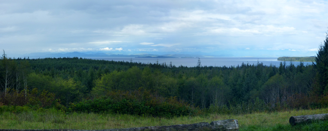
The drive north on Route 19 along the shore and over/through the mountains is extremely scenic. Heavily wooded mountains that reach right down to the sea and up to the sky are a sight to behold, but difficult to capture in photographs as the views are so vast. Click on panoramic below for a slightly better look.
Port Hardy, the region’s largest town, is located at the northern end of the paved highway. This road, which was not completed until the 1970’s, has some history to it, as indicated on this interesting monument in Carrot Park. If you can’t read the inscription here, click on the photo to view it larger. If you still can’t read it, hold your control button and plus symbol down simultaneously to blow it up further. If you don’t know that little trick already, you might find it useful.
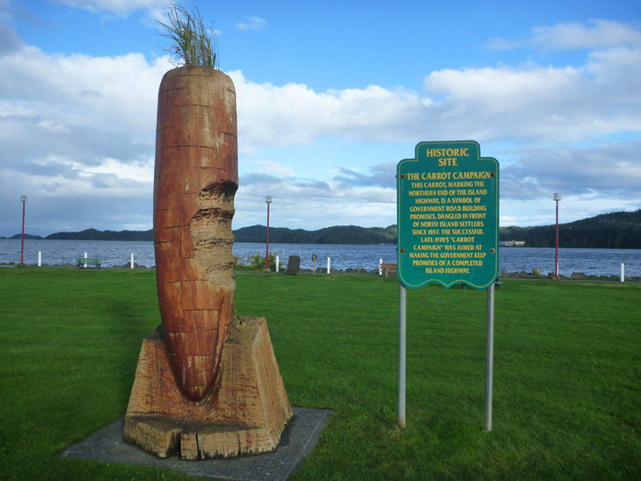
While doing some online research on the Carrot Campaign, I came across the World Carrot Museum (who knew?!) website that (of course) features this monument, including the inscription. Scroll about halfway down their home page to view it.
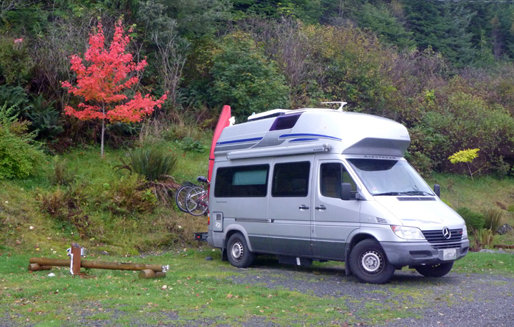
Not letting the previous night’s roust dampen our enthusiasm for boondocking, we boldly parked right in the Visitor Center parking lot overlooking the bay. While I was preparing dinner, distant sirens drew nearer. Soon a firetruck turned into our parking lot and headed right towards us, turning abruptly off just a few feet from the side of haRVy (really – see photo below!). What could this be about, I wondered!
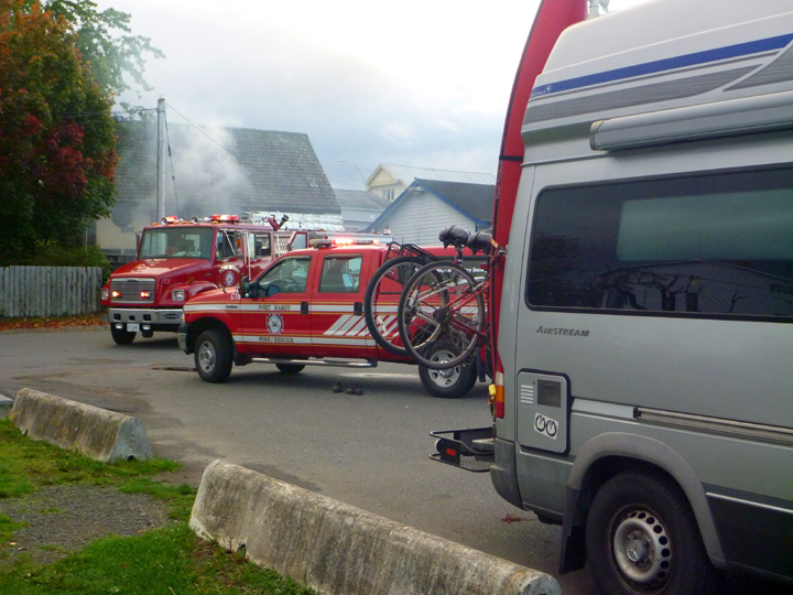
Somehow a small fire had started under the abandoned house right behind us. The whole town, including the police and fire departments, now knew where we intended to camp, but once the fire was extinguished we never saw another official. Seems they are a bit more relaxed about such things up here.
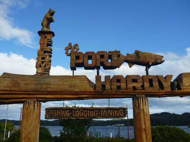
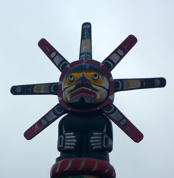
Northern Vancouver Island is loaded with carved wooden signs, totem poles, and monuments. This tradition links to the indigenous First Nation inhabitants of the area. Descendants have proudly taken up the craft (trade?) once again.

The weather was not very cooperative, with quite a lot of wind and rain, but we managed some interesting outings between the worst spells. One was a drive out to historic Fort Rupert, the site of a former Hudson Bay Company fort. The site today is a Kwakwaka’ wakw village where visitors can see native carvers working on totem poles or other artwork and traditional crafts. We only saw one carver working, but we did see a lot of their finished work all around the village, most notably in the cemetery.


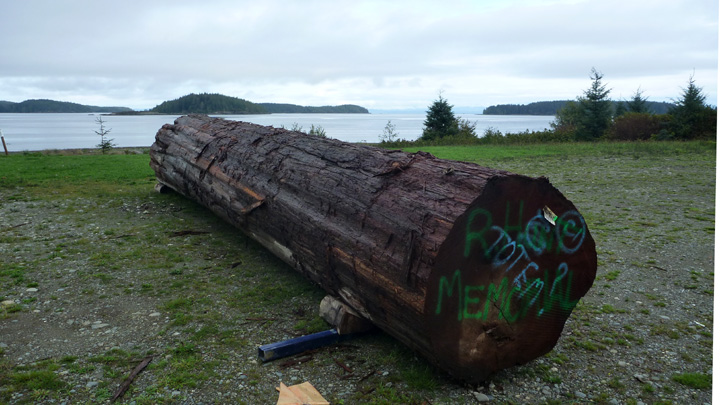
Log earmarked to become a memorial totem pole.
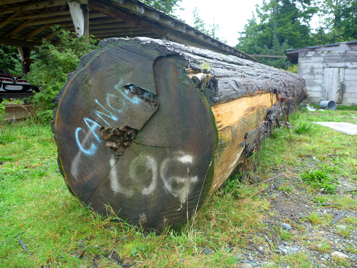
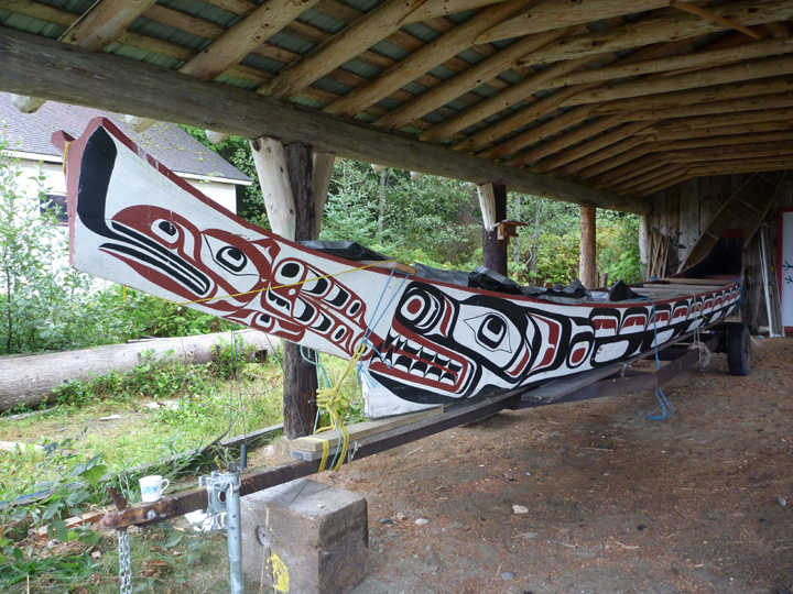
This log is destined to become a carved canoe like the finished one below.
I have learned to love their nature-inspired artwork.
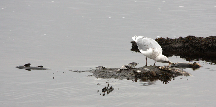
While walking along the estuary, we witnessed an interesting natural phenomena. What do you suppose all these seagulls are so excited about?
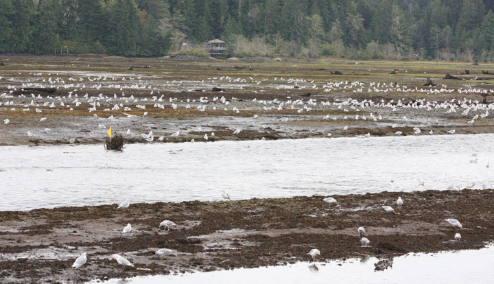
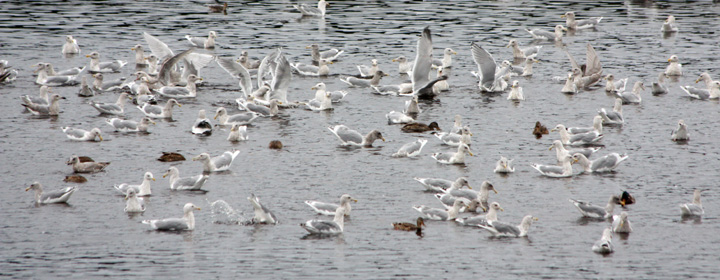
We had not yet been lucky enough to see salmon swimming up river to spawn, but here the dead carcasses were being washed back down the river where the gulls feasted upon them. Not quite the same type of experience… actually almost kind of gross, until you realize that the remains of those fish are feeding many different types of wildlife and even the surrounding soil and flora.
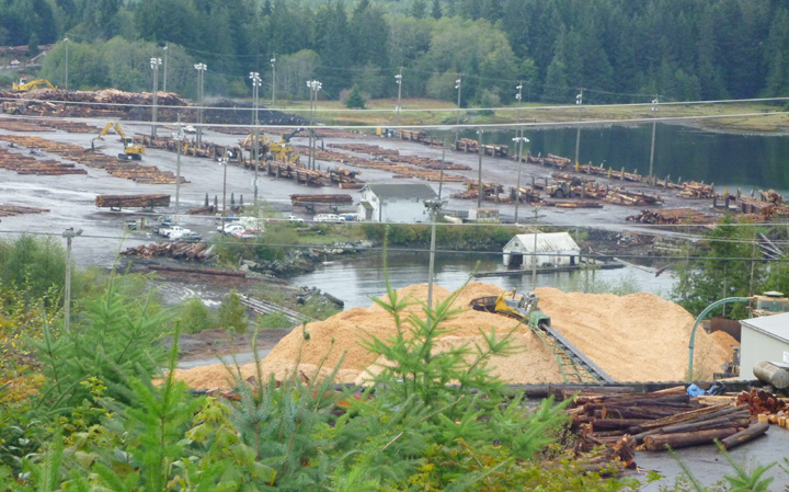
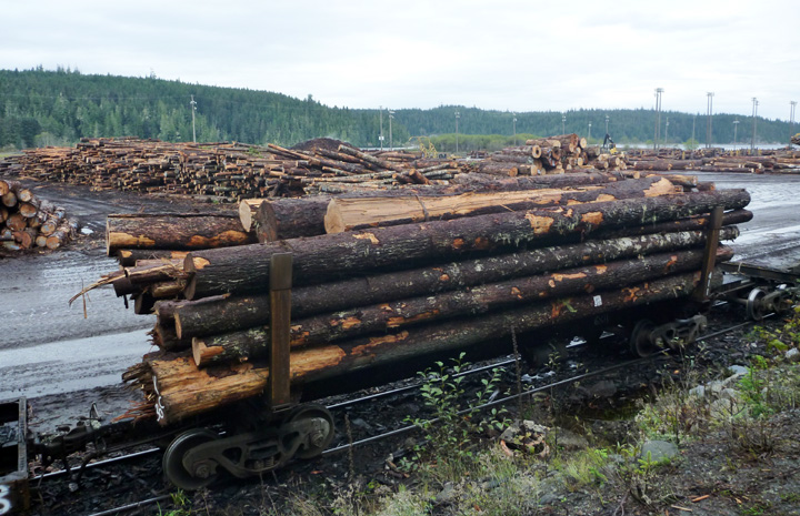
Lumber is BIG business in these parts. Evidence of that fact is everywhere – speeding logging trucks on the roads, clear-cut scars across mountainsides, and log sorting operations in the bays and waterside lots. Even with all that logging activity, it is unbelievable how many mature trees still stand all across this vast island.
A bit further south at Port McNeill we had hoped to take a ferry to Alert Bay on Cormorant Island. The oldest community in North Vancouver Island, the Cormorant Island fishing community was an important trading center for early residents in the area and has been the traditional home of the Namgis First Nation for several thousand years.
We were informed that the usual ferry was not running due to construction work on the new terminal. That meant we could not take haRVy over and camp overnight as planned. We decided we would just do a long day trip over to see the highlights, so we camped nearby and got up at the crack of dawn to board the first ferry. The ticket seller informed us that high winds were expected that would likely cancel afternoon crossings, which would strand us on the island without a place to stay. Seemed clear to us that visiting, Cormorant Island was just not to be at this time, so we headed on down the road to Telegraph Cove instead.
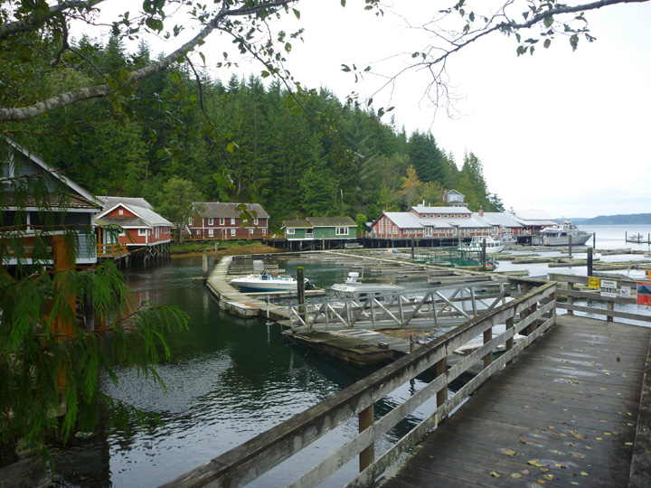
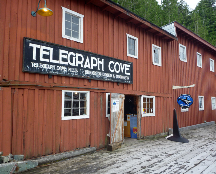
This tiny sawmill and cannery community was important to the development of the North Island and has a rich and colorful history. From 1911 when the first telegraph operator took up residence in Telegraph Cove this little cove has been a unique part of Northern Vancouver Island. The resort, which maintains the boardwalk village in as close to original conditions as possible, was closed for the season, but we were still able to walk around the picturesque site. At the end of the dock we were surprised and happy to find the Whale Interpretive Center open.
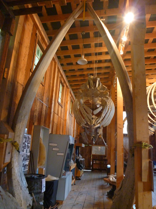
Check out those whale jawbones standing in the foreground!

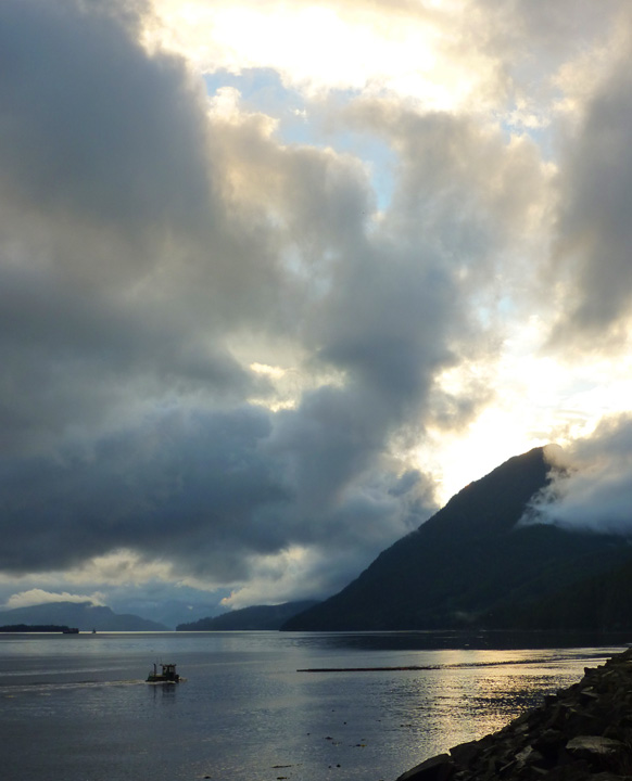
Our next detour off the main highway as we headed south took us into Sayward. However, the best surprise appeared just past the village at the end of the road. Kelsey Bay, with its quaint 6-space campground overlooking the Inside Passage captured our hearts immediately. We stayed for two nights, but never got to see the place with any sun shining. We just might have to return someday, but I understand that you must book a campsite a year in advance!

Panoramic view from campsite. Click image to view larger.
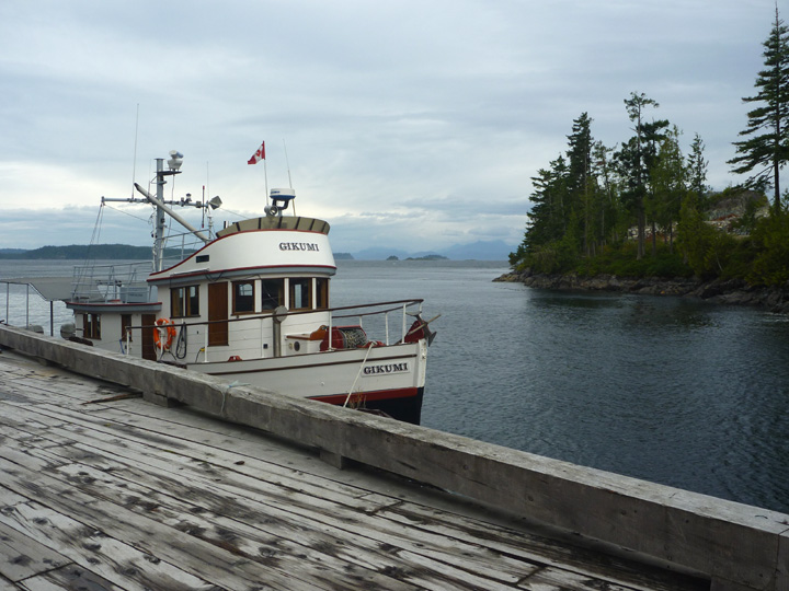
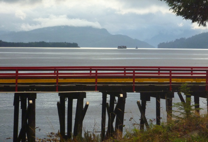
The wharf (above) at Kelsey Bay was once the southern terminus for the B.C. Ferries Inside Passage route until 1978, when Highway 19 was extended north to Port Hardy. It is now a convenient stopping point for sport fishing and eco-tourism. Fresh seafood is reportedly often available from one or more boats tied up at the wharf. We saw none of that activity during our off-season visit.
We are the only campers here during our stay.
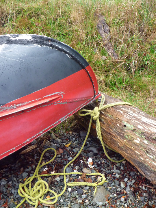
No anchor? Just tie the boat to the nearest log.
These tiny little boats are used to sort and move logs.
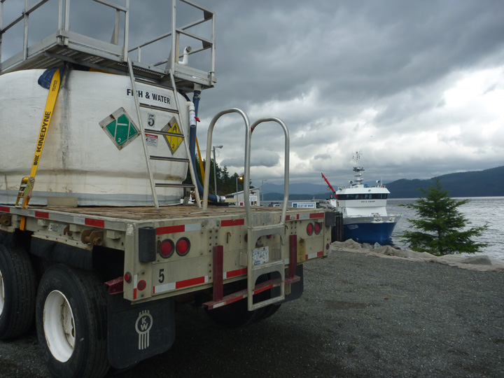
This truck (and a dozen more like it) was off-loading baby Atlantic salmon from an onshore hatchery onto the waiting ship for transport to the offshore farming pens.
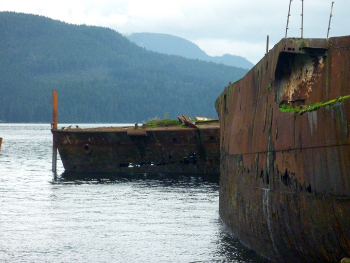
Four old ships were brought here to serve as breakwaters for the log booming grounds and the small boat harbor.

This one, the SS Cardena, served as the flagship of the Union Steamship fleet on the BC coast for three decades.
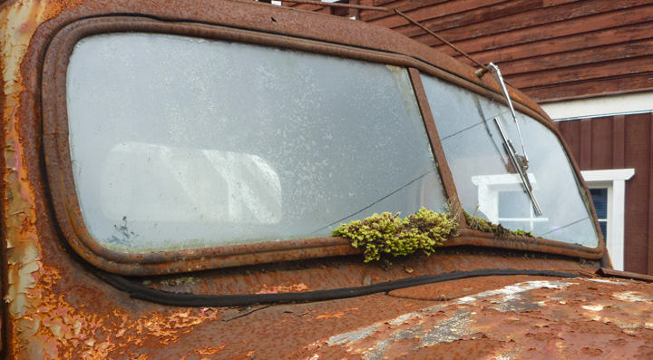
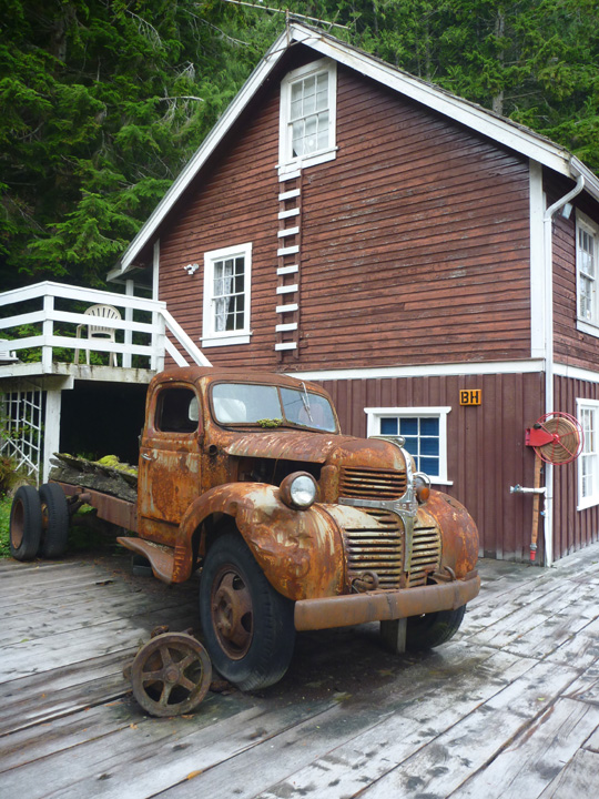
Safety is no longer provided by these glasses.
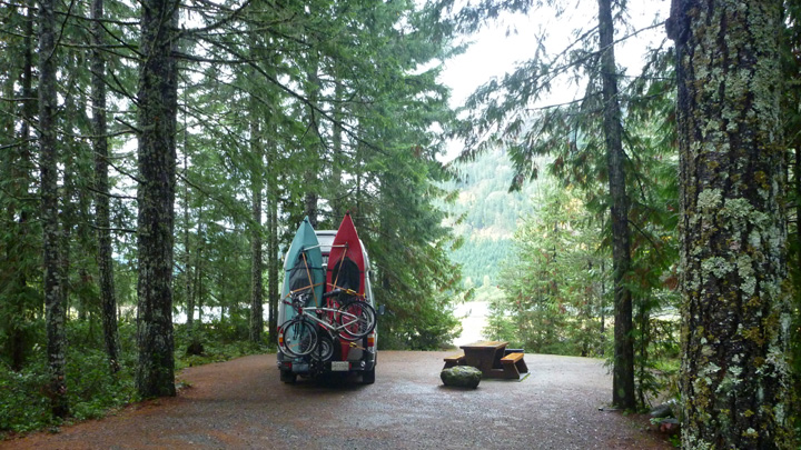
We had a very enjoyable and informative visit to the Museum at Campbell River before driving another beautiful windy road (Route 28) into the interior to visit beautiful Buttle Lake in Strathcona Park. Once again we are the ONLY campers in the campground that has over 75 sites!
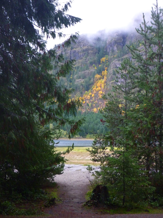
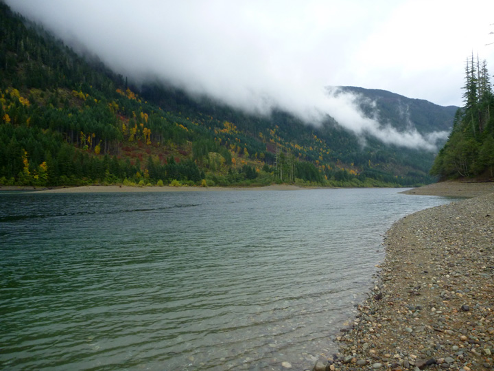
Just a glimpse of the lake from our campsite.
All the sites in the BC Provincial Parks are as pristine and level as this one. America’s National Parks should take note.
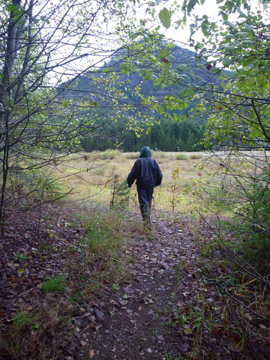
A little hike around the lake between rain storms.

Another obligatory selfie.
Absolutely nobody else around…

Plenty of mushrooms though. Think these are edible?
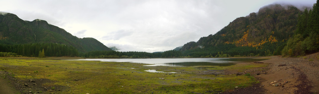
Panoramic of Buttle Lake.
We are now back in Jason and Sunday’s driveway (thanks again guys) in Courtenay waiting out yet another massive rain storm. It looks like we might get a bit of better weather over the next week before we head back to the United States mainland. We are keeping fingers crossed.

Really enjoyed this post with so many stunning photos. Be sure to leave time for tofino on your way around. Great kayaking there is warmer months.
By: David Galson on October 22, 2014
at 11:58 am
We visited and enjoyed Tofino (a touch of SoCal in BC!). No paddling though as the weather was not great.
By: sunnyharvy on October 24, 2014
at 1:11 pm
Love the selfie. And the carrot story. And carvings. And the wonderful wonderful photos. Jim and I should so be up there with you!
By: jsahady on October 22, 2014
at 12:09 pm
YES, you should be. That would be SO much fun!
By: sunnyharvy on October 22, 2014
at 1:34 pm
The psychoactive mushroom Amanita muscaria, commonly known as “fly agaric” The red mushroom……….looked it up.
By: Judy Lindeman Fullerton on October 23, 2014
at 3:29 pm
Really? Maybe I should have tried a bite, eh? Looked pretty scary so I wasn’t tempted.
By: sunnyharvy on October 24, 2014
at 1:11 pm