Don’t bother trying to make sense out of our travel route this winter. We are moving about Southern California “Hoobley Shoobley” as my good friend Sharon would say, seeking (and finding!) good weather while also dropping in on friends and relatives along the way.
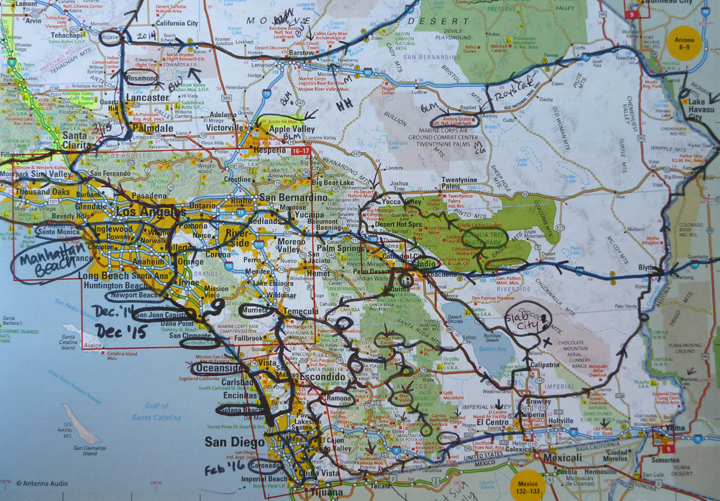
The lines on our road atlas represent routes taken during three consecutive winters in Southern California.
From MaryEllen’s place in Indio, CA, we drove over the mountains on Highway 74, the “Palms to Pines Scenic Highway,” which it truly is. Our winding journey began in the low desert at just 220-feet of altitude. We ate lunch at 4,000-feet at Pinyon Flats and camped in the Cleveland National Forest at 2,800.

Yet another nearly empty campground. This one is in Oak Grove.
Our next stop was in Ramona, CA to visit with my niece Kim and her husband Andy who offered us free overnight camping at the VFW there. Good to see them both again, it had been a while.
We were yearning to see the Pacific Ocean again, so it was on to San Diego and Fiddler’s Cove Campground and Marina on the Coronado Strand.

View from campground of yachts and the Coronado Bridge with San Diego skyline beyond.
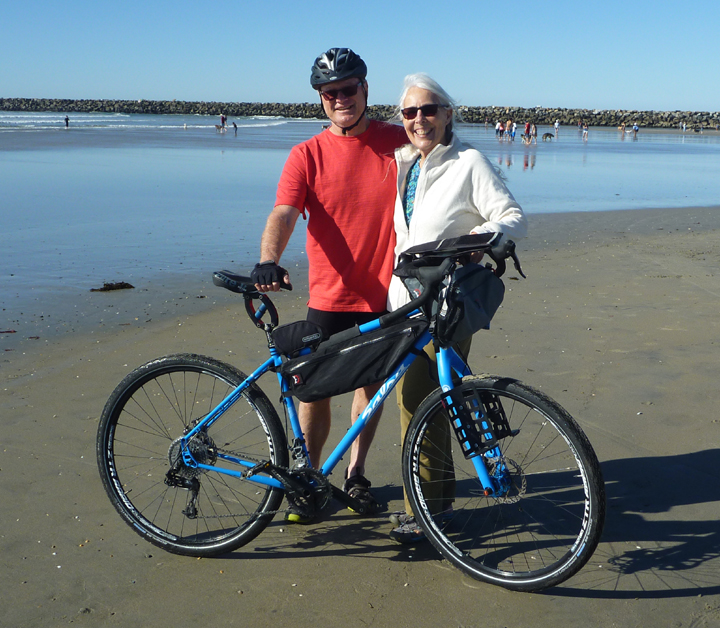
We spent a fabulous day riding our bicycles all around Coronado in glorious weather. Lunch at Spiro’s Greek Cafe at Ferry Landing, desert at Nado Gelato, and a walk on the beach were some of the highlights. I forgot to bring my camera, so no photos…sorry.
The next day we visited two more beaches in the area. This time I did carry my camera.

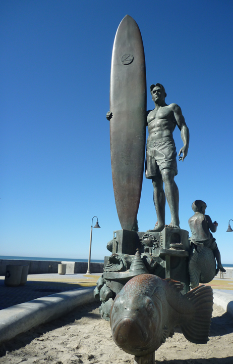
Imperial Beach is the southwestern-most city in the continental United States. It is a classic Southern California beach community, having remained largely unaffected by the rampant development and exclusivity characterized by beach cities up and down the California coast.

This town really embraces its surfing heritage.

Evidence of that fact is all around.
We had a date to meet our friends Ed and Penny from Arcata, CA at Ocean Beach where Ed was to set off on an epic 3,000+ mile bike ride across the Southern Tier of the United States. Penny will drive the support wagon, their brand new Ford Transit.

Ed ceremoniously dips his tires in the Pacific Ocean.
Penny gives Ed a big sendoff.

And Al cleans the sand off Ed’s wheels and tires. Good luck Ed!
We then headed inland on Historic Route 94, which proved to be another scenic drive reminiscent of Old California with very little traffic since it doesn’t go directly to any place of significance. Our kind of road.

Quick stop and look around in Campo at the Pacific Southwest Railway Museum.

Thanks to our Harvest Host membership we camped for free at the Imperial Valley Desert Museum in Ocotillo, CA, where I enjoyed an early morning walk about before viewing the interesting exhibits.
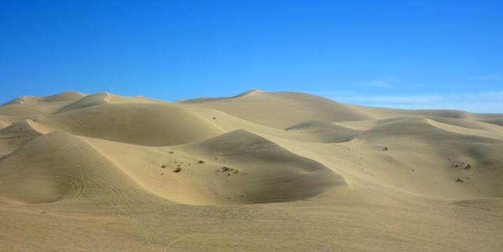
Algodones Dunes Wilderness, one of the largest dune complexes in North America.
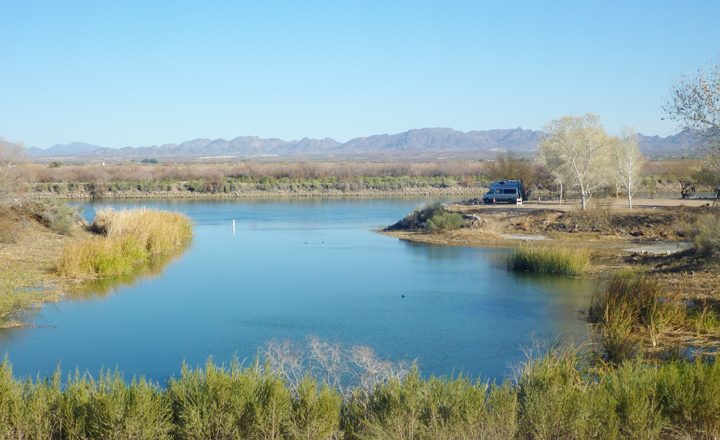
Camped on the Colorado River.
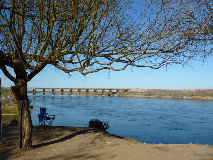
Campsite view.
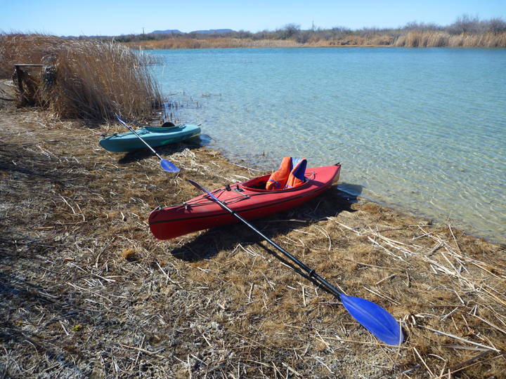
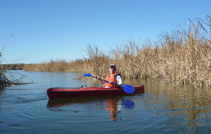
Paddling nearby Oxbow Lake.

Look WHO visited us. Beautiful Great Horned Owl.

Wild camping on BLM land near Lake Havasu.

Sometimes there is no alternative to an Interstate Highway. SO boring!

This type of road is much more to our liking.
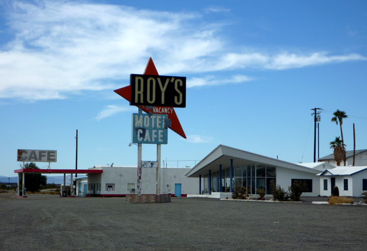
Especially when it heads to a place like Amboy, CA!
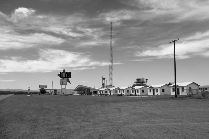
Roy’s Motel and Café, which prospered due to its isolated location on Route 66, opened in 1938. It prospered until the Interstate 40 bypassed Amboy in 1973. It was purchased by Albert Okura in 2005, who offered $425,000 in cash and promised to preserve the town and reopen Roy’s. The deal included about 490 acres, including the church, post office, three gas pumps, two dirt airstrips and other buildings in the town. Today the motel is used as a stage for art exhibits and there is a rather uninspired gift shop in the cafe. The lack of an adequate potable water supply prevents further development.
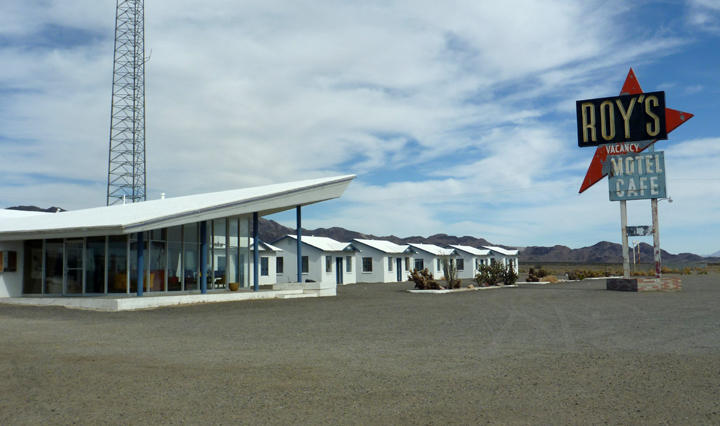

Historic Route 66 in Amboy.
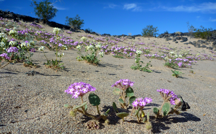
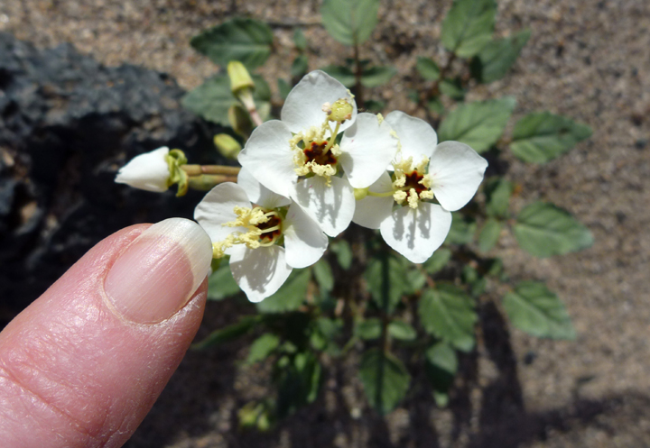
The desert is abloom due to recent rains.
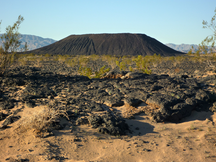
This 250-foot-high Amboy Crater is one of the best examples of a volcanic cinder cone in the Mojave Desert. We camped nearby free of charge thanks to the Bureau of Land Management (BLM).
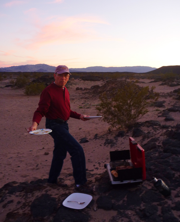
My man grilling up dinner as the sun sets over the desert.

Cool hoobley shoobley! Ed has quite the expedition – wowie. Love the owl and all! I was in San Diego last week for a conference and fun for a few days.
By: Leslie James on February 12, 2016
at 2:40 pm
Nice photos! You were in the area where I grew up – looks like you even went through Lakeside. Not my favorite place now – too crowded and a bit trashy. But many years ago, it was a fine place to be a kid. Coming to New Mexico?
By: Donna Catterick on February 12, 2016
at 3:18 pm
We already went through New Mexico a couple of years ago, Donna. Sorry we didn’t get to meet you when we were there. Really liked Truth or Consequences.
By: sunnyharvy on February 12, 2016
at 11:49 pm
Not letting me comment again…
You do know why Imperial Beach isn’t as populated…..major sewage problems…..
By: onlyonejudy on February 13, 2016
at 3:13 pm
Was there still the strange installation on saving water at Roy’s? We’re at the cabin so couldn’t get photos, have to wIt until we get home Mar h 1. Waiting to hear more
K&C
Sent from my iPhone
>
By: Keith Chamberlain on February 16, 2016
at 1:44 pm