
To View Our New Year’s Greeting
We are back onboard haRVy,
so you can expect to see more blog posts soon.
We look forward to reading your comments.
Thanks for following!
To View Our New Year’s Greeting
We are back onboard haRVy,
so you can expect to see more blog posts soon.
We look forward to reading your comments.
Thanks for following!
Posted in Uncategorized
We headed south along the Hood Canal from Port Townsend. On Nancy’s recommendation we stopped in the extremely charming little town of Port Gamble for lunch. Now a National Historic Landmark, the mill town has been restored to its 19th century decor, which we found reminiscent of New England. Sorry I didn’t take any photos (too rainy), but you can see several good ones by clicking on the link above.
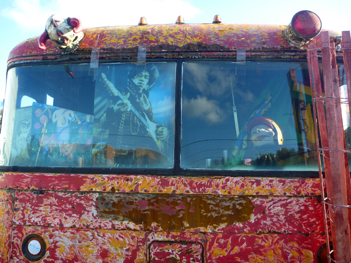
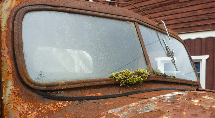
On our way down Highway 101 we spotted this forlorn looking RV. We’d never seen anything like it so we turned haRVy around to have a closer look.
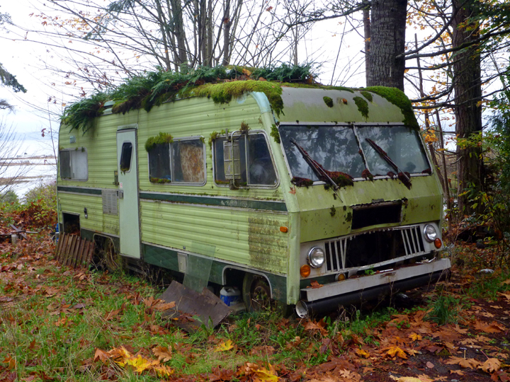
At first it seemed sort of amusing, but the more we looked around the more we wondered what the full story could be.
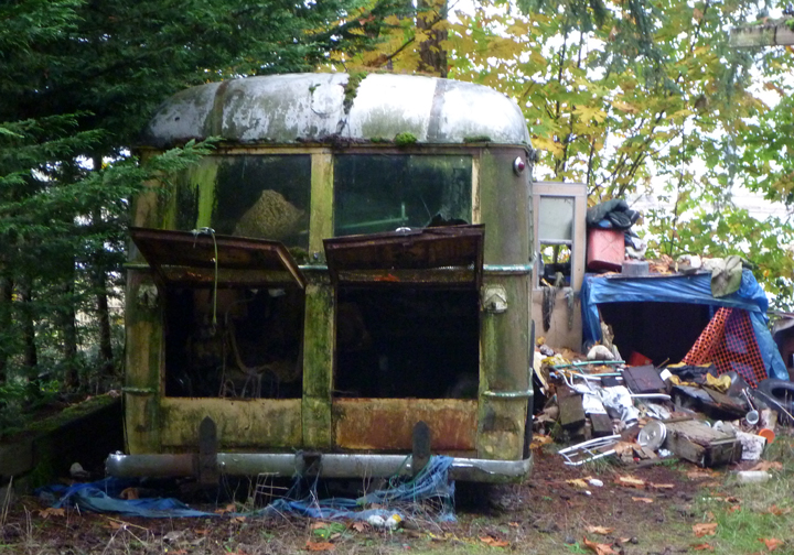
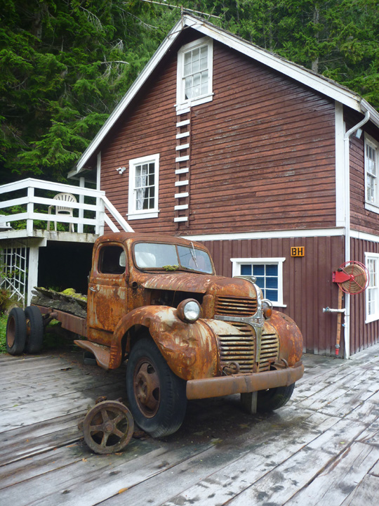
This old bus based RV was in the yard on the other side of the humble house below. Even the engine had been stripped out of it. I wasn’t brave enough to walk over and look into the open side door.
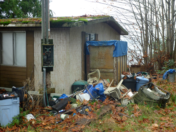
In front of the house was this pile of rubble, which contained a wheelchair, portable commode, and other evidence that the former resident probably spent his last days here after years of accumulating “stuff” around him. I was tempted to go into the saloon next door to find out the true story, but decided to leave well enough alone.
A little further down the road…
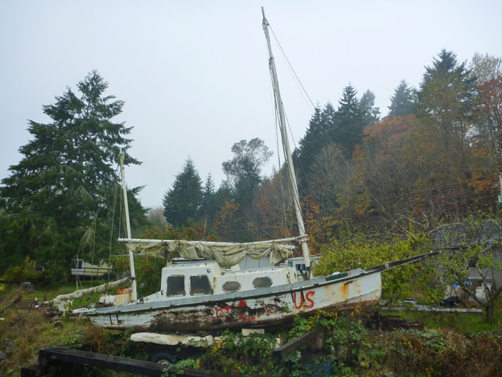
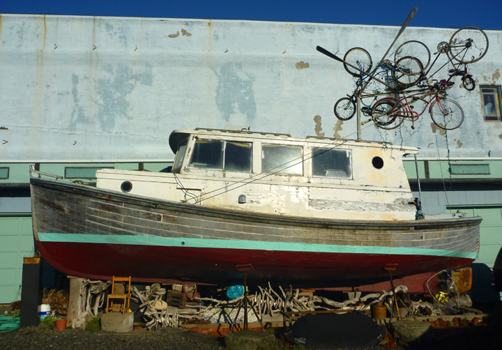
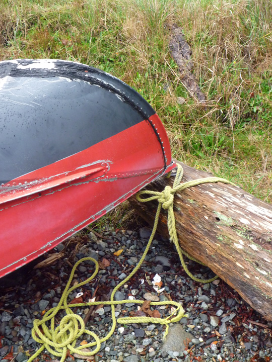
I don’t think this boat has seen the water for quite some time, but the sail is still on the boom ready to hoist!
Our free camp site that night was at Hoodsport Winery, a member of Harvest Hosts. They have been in operation since 1978. Practically every inch of wall space in their tasting room is covered with awards. They are best known for their fruit wines, but I really liked the Rhubarb, so I bought a bottle, which I later shared with some new Westy owner friends (more below).
Next we spent a night with Boondockers Welcome hosts Colleen and Dale at their lovely home in the Black Lake neighborhood near Olympia. They own a VW-Synchro that was converted for camping by Westfalia, so they were interested to see our more modern Westy. Nice folks. Colleen is a great photographer. You can see her work here.
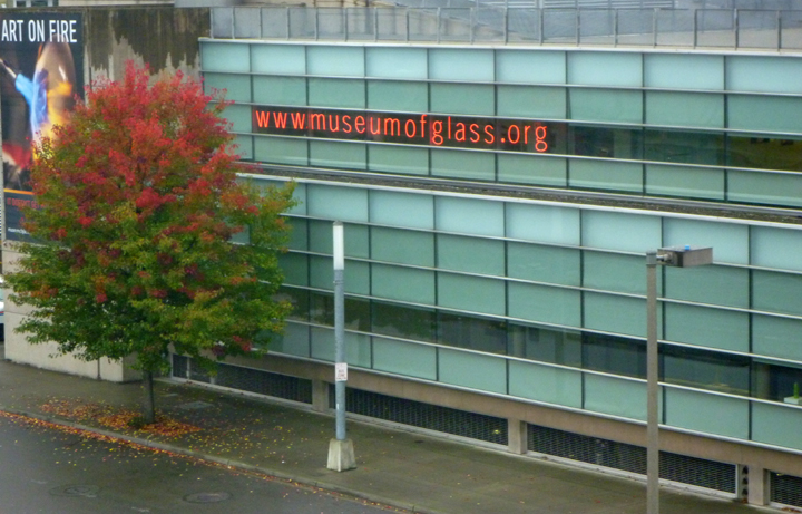
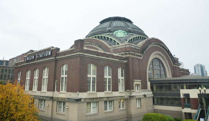
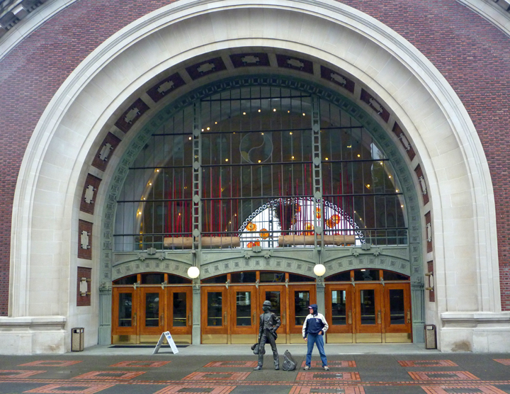
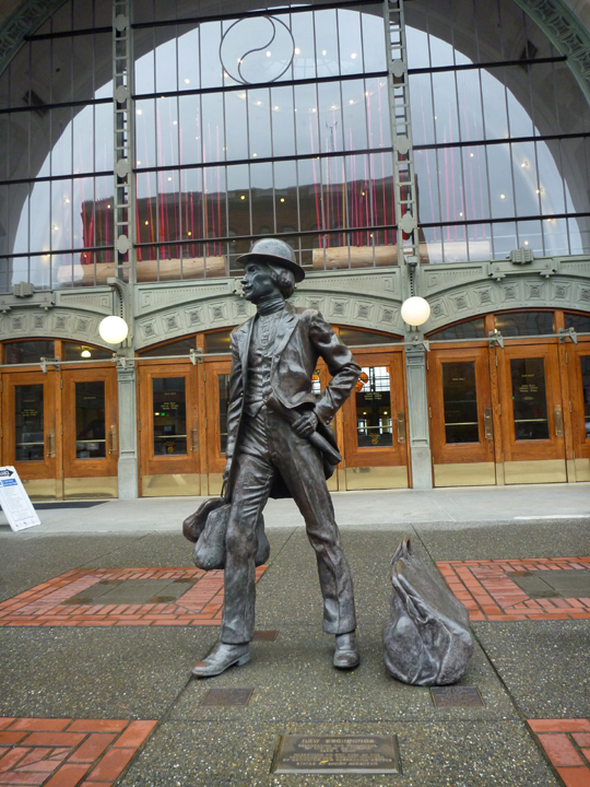
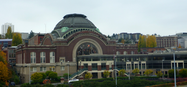
In Tacoma we spent an enjoyable afternoon touring the Museum of Glass, the meticulously restored Union Station that now serves as a Federal Courthouse, and beautiful Point Defiance Park.
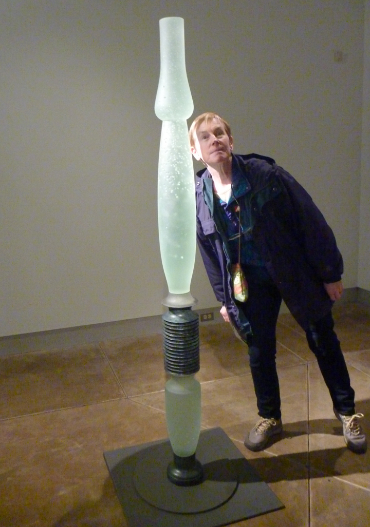
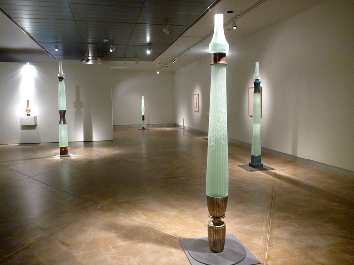
My favorite exhibit featured work by Howard Ben Tre.
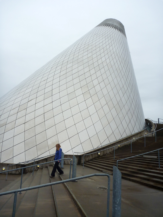
The “cone” contains the “Hot Shop” where visitors can witness art coming alive as the Museum’s team and visiting artists demonstrate the fascinating process of creating works of art from molten glass. You can see what’s going on there right now (during museum hours) or watch recently taped videos on their website here. It’s pretty cool….oh I mean hot!
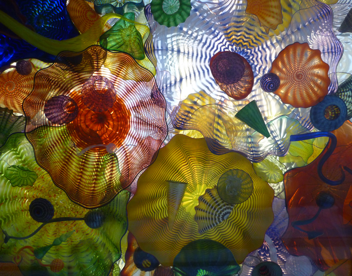
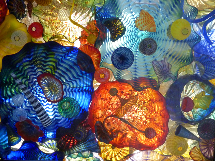
The walk from the museum to Union Station took us over the “Bridge of Glass” that is festooned with works by Dale Chihuly. Below are photos showing two overhead panels in the Seaform Pavilion section where the ceiling is filled with 2,364 objects from Chihuly’s Seaform and Persian series.
Boondockers Welcome hosts Dean and Sue welcomed us to their home in Des Moines (we are still in Washington, not Iowa!) that evening. While in town we took a walk along Des Moines Creek Trail and visited the City Marina.
Just north of Seattle we stayed two nights in the driveway of fellow Westy owner, Michael, who we met a few months ago in Yellowstone National Park. We enjoyed a pleasant stay, nice visit, and delicious lunch which he prepared for us.
In Kirkland we stayed two nights with Pauline and Steve who also own a Westy. They not only hosted us, but organized a delightful (and delicious) dinner gathering of Westy owners (and wannabee John) around our visit. Thank you both – we had a fun time getting to know you and the others.
Now we are preparing to fly home for a friend’s wedding. This diversion from our travels with haRVy will extend through the holidays. During this time I will take a break from this blog. Happy Holidays To All – see you in the New Year!
Posted in Washington
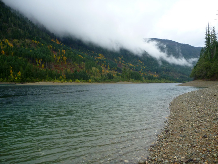
Our first stop after crossing back into the US of A was at Port Angeles, WA, where we actually enjoyed a few hours of sunshine! Unfortunately, it didn’t last long. These past few weeks have been the wettest I have ever experienced and the forecast doesn’t call for it to quite anytime soon. Oh well, haRVy is doing a good job of keeping us warm and dry, so we can’t really complain (much).
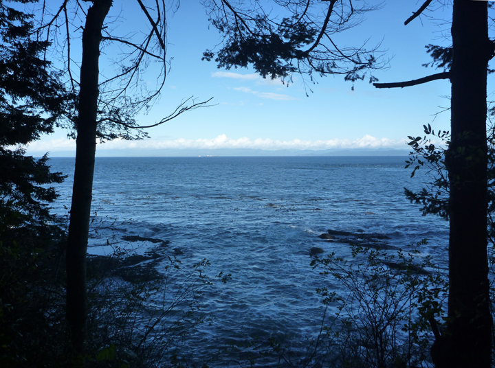
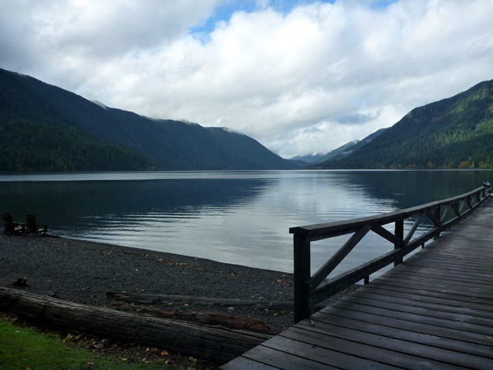
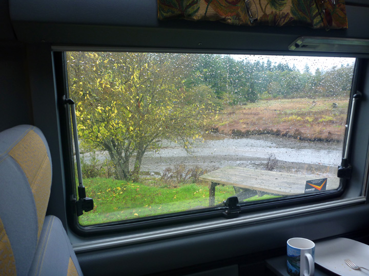
On a recommendation from the Port Angeles Visitor Center attendant, we headed a few miles west along the shore of the Strait of Juan de Fuca to Salt Creek Recreational Area. We chose a beautiful campsite on the bluff. There were only two other campers in the entire campground, who chose the open (windier) area in order to have electrical hookups. This allowed us to snag the best spot in the woods. I later found out that a fellow Westy owner had camped in the same exact site a couple of weeks earlier.
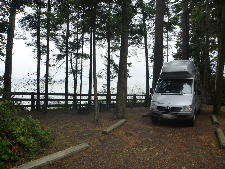
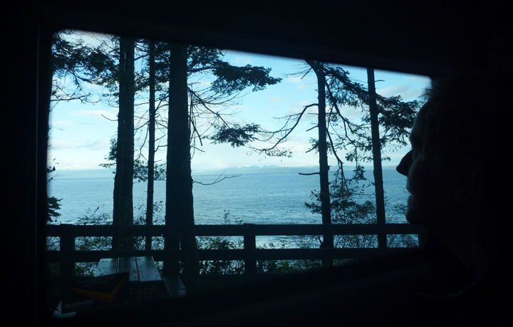
Enjoying the view from our snug shelter. That’s Vancouver Island across the Strait.
We managed to take a couple of hikes around this beautiful park between intermittent showers.
The creek after which the park is named.
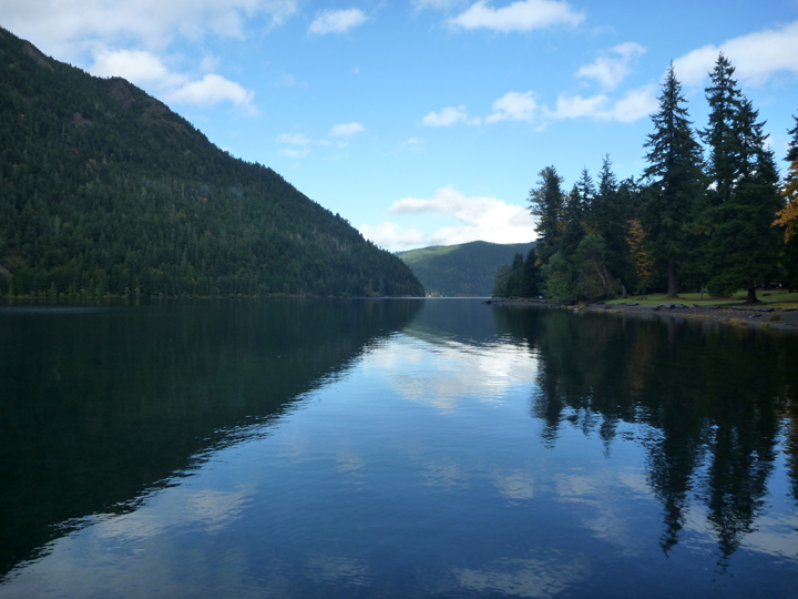
We enjoyed two quiet days and nights at Salt Creek before moving on. We then took a drive into nearby Olympic National Park to see the area around Crescent Lake. We had hoped to bike or hike there, but the weather did not cooperate. By the time we finished lunch it was raining again.
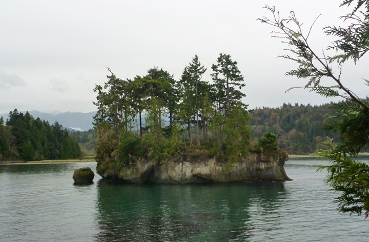
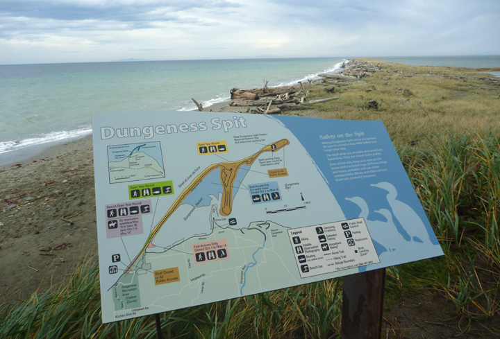
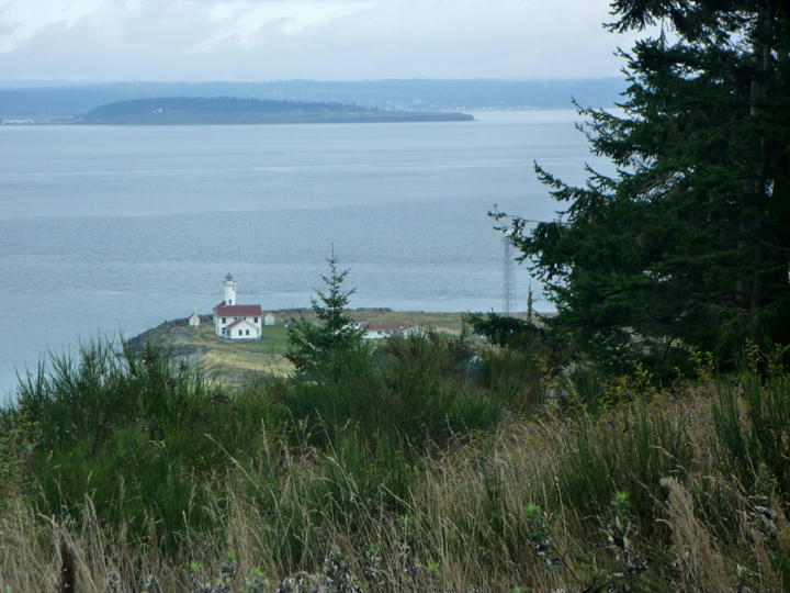
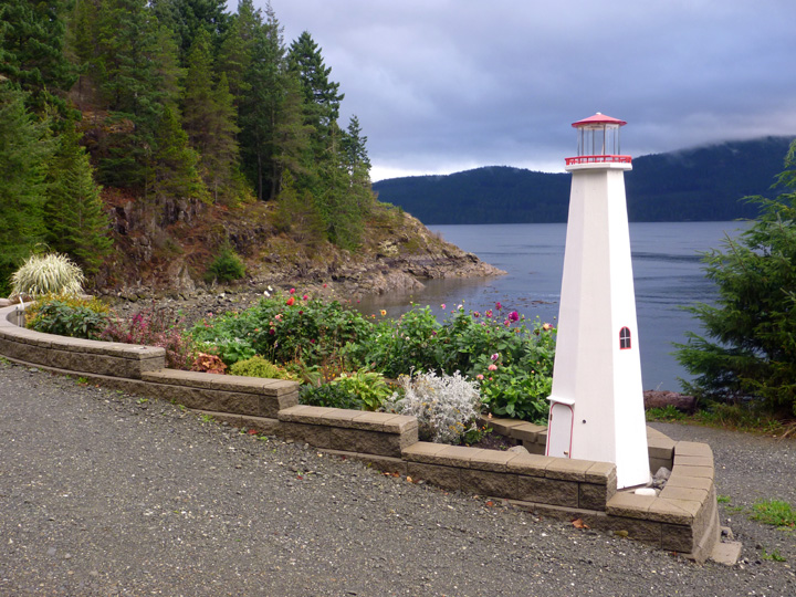
That evening we camped at Dunguness Spit, the longest natural sand spit in the United States. It is a 5-mile hike in the sand to get out to the lighthouse at the end. So far away that you can’t even see it in my photo.
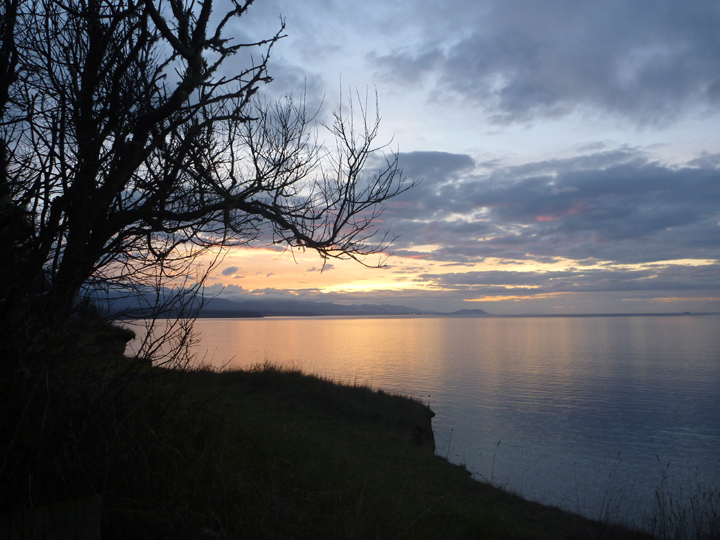
Nice to see a sunset after so many dismal gray skies.
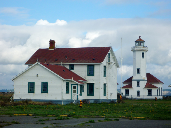
We then moved on to charming Port Townsend, WA to spend a few days with another of my high-school girlfriends, Nancy and her life partner Mark. Thanks for the hospitality and great meals guys! It was nice to take a break from cooking and to have time to catch up on each other’s adventures. Nancy and Mark spent ten years sailing from the Arctic to the Antarctic and back. They now keep their boat in Alaska and sail there for several months each year. Plus, Nancy is hiking the Pacific Crest Trail a few hundred miles at a time. Our little expedition pales in comparison, but it suits us well.
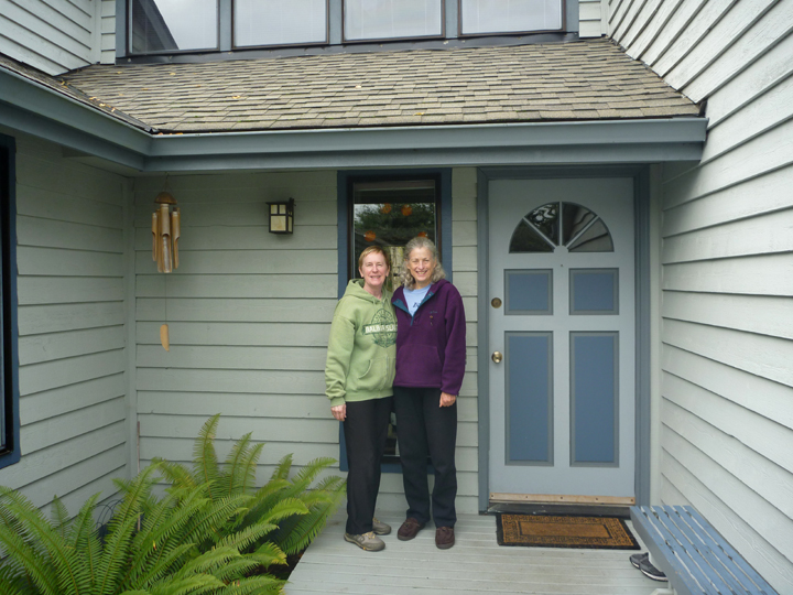
Me and Nancy at her Port Townsend home.
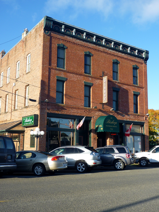
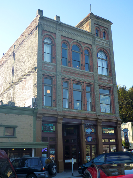
Downtown has lots of interesting old buildings.
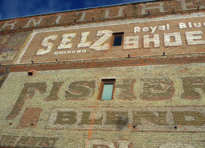
And some quirky stuff too.
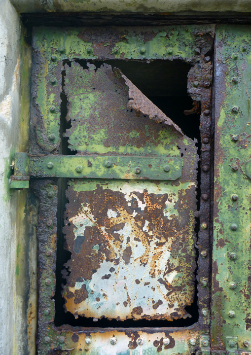
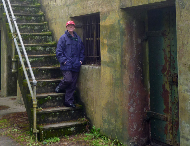
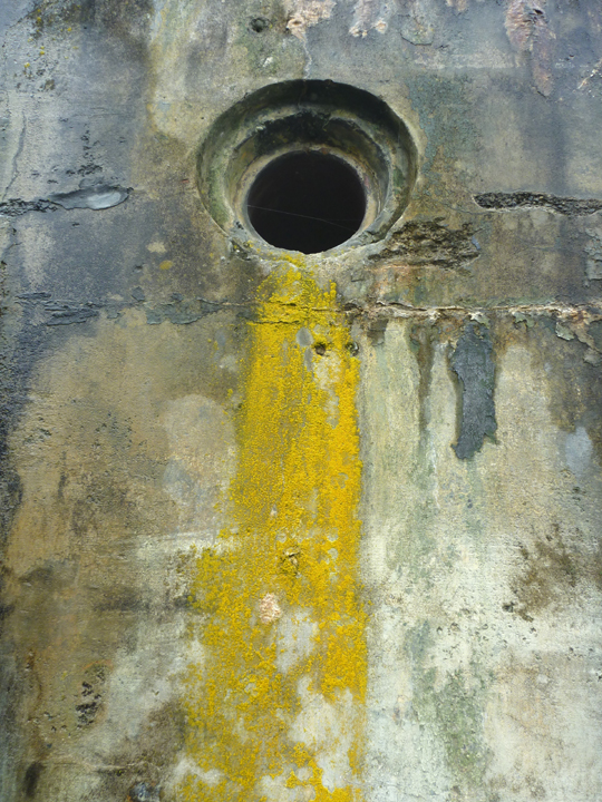
Al and I got out to Fort Worden State Park for a look around the historic batteries and other fort relics. It is a beautiful park overlooking the entrance to Puget Sound.
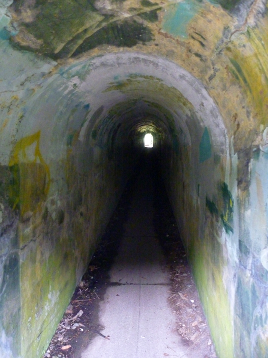
Lots of colorful and textural stuff to photograph here.

The extensive main battery.
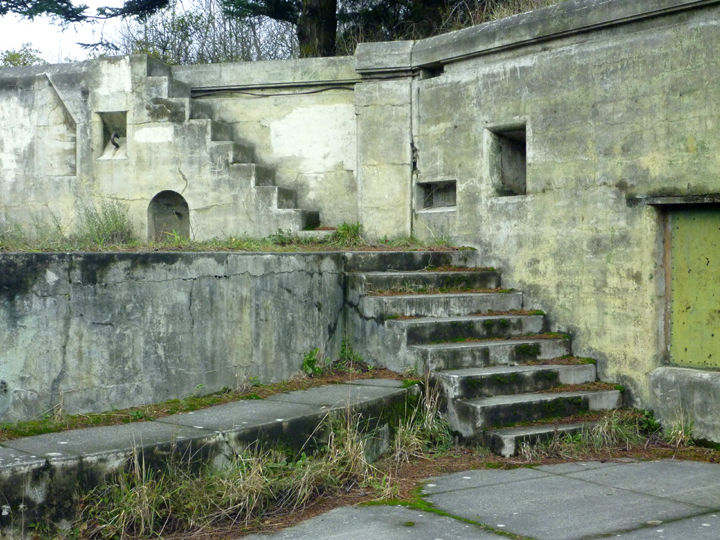
This somehow almost felt like a Roman ruin to me.
Posted in Washington
Good thing we stopped at Jason and Sunday’s in Courtenay again as the wind and rain were ferocious for most of the two days and nights we were parked in their driveway. We are so grateful that haRVy provides us a warm and dry living environment even during wild stormy weather. This trip would have otherwise ended long ago…
The skies were fairly clear the second morning of our stay at Jason’s, and we were getting a bit stir-crazy, so we decided to go for a hike in Seal Bay Nature Park that encompasses the woods behind his house. He warned us that the trails can be tricky and to be careful so as not to get lost. We carefully chose our route on the main trail, which seemed like the safest option, and headed off for what we planned to be an hour or so.

Some seriously tall trees here.

No idea how this car got so deep into the woods.
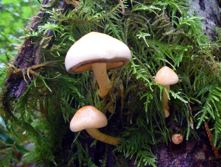
Lots of fungi around due to all the rain.
Well…guess what? We got lost! We came out on a back road that we hadn’t seen on the trail map and had no idea where we were. Luckily, thanks to Jason’s warning, Al had brought his GPS. Unfortunately, it navigates roads, not trails, and it told us it would be a 3.5 mile walk back. And, of course, it had started raining again (ugh)! Al wanted to delve back into the woods, but I took action by flagging down the second car (driver of first one totally ignored me) that came by. Can you believe that his intended destination was within 2 blocks of where we needed to be. What are the chances of that? I was extremely grateful and happy to be back in haRVy a couple of hours later than anticipated.
After restocking our food supplies and a great lunch at Jason’s friend Ben’s cafe (The Hut on Duncan Avenue) we were back on Route 19A heading south along the shore.
We followed a few dead ends that were scenic…

Could almost be New England, eh?
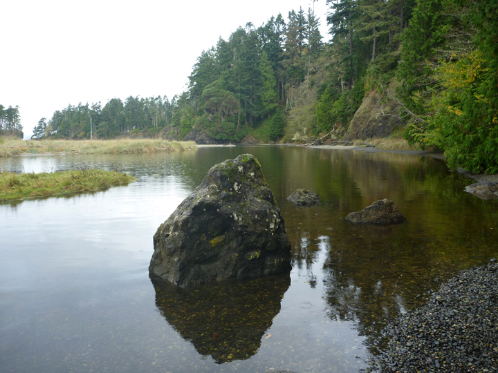
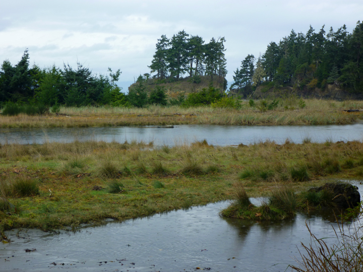
And finally followed a sign to the marina at French Creek where we paid $5 to park overnight next to the estuary of the creek.
Breakfast view where we watched all sorts of birds cavorting about.

Would love to know the story behind this unique place AND its owner.


Just one of many interesting things strewn around the yard.
The next day we spent the better part of the afternoon walking around the harbor area of Nanaimo, one of the larger cities on the island. We ran across an enthusiastic group of astronomers that were viewing a partial eclipse of the sun in-between breaks in the clouds. They were happy to let anyone look through their telescopes and share their viewing glasses.


Seaplanes are everywhere on Vancouver Island, but we hadn’t previously seen many luxury yachts.
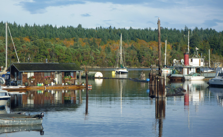
Our next stop was in the charming little town of Ladysmith (great name, don’t you think?). Here’s a photo of their much more laid-back and picturesque harbor.
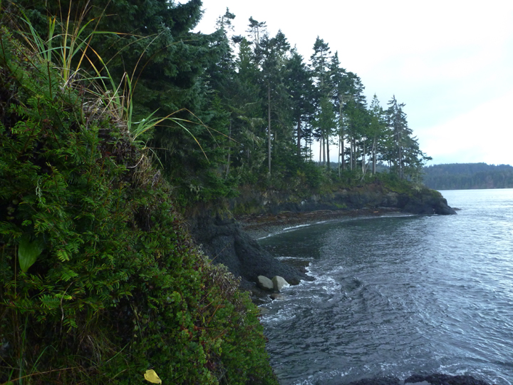
The next day we were headed to our final west coast destination of Port Renfrew. After traversing the island on a beautiful but narrow winding road surrounded by some pretty stunning fall foliage, we were ready for a hike out to Botany Bay.


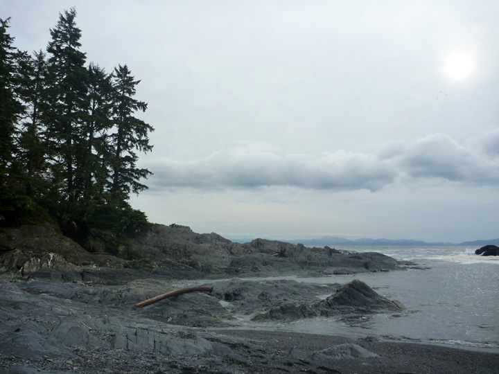

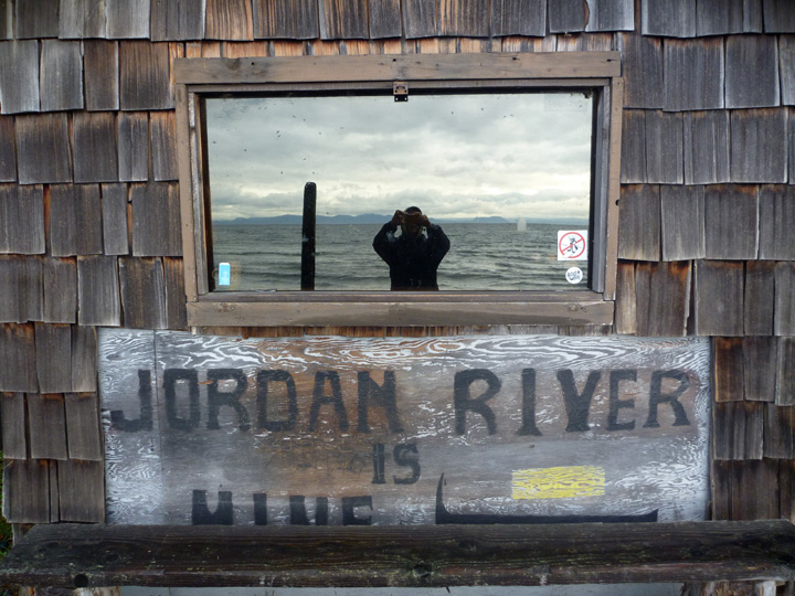
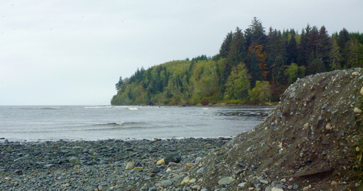
We didn’t like the looks of the campground at Port Renfrew so we took a left turn on the coast road and found a fantastic little campground at an active surf spot called Jordan River. The whole scene reminded me of SoCal beaches back in the 60’s, beach shacks and all. Just needs some nice soft sand to cover all those rocks.

Our last stop of any consequence on Vancouver Island was in the area of Sooke where we took a walk out on the lengthy Whiffin Spit that provides protection to their large beautiful harbor. We also drove up the Sooke River to view a few late season salmon trying to make their way to their spawning grounds. We settled in for the night at “Sunny Shores” where it rained (again) for nearly 24 hours straight.
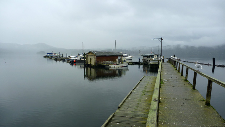
Sunny Shores harbor

No idea what this used to be, but it was covered in slime like I’d never seen before.

The owner of this fishing vessel didn’t yet know where his boat had been blown in the storm.

Whiffin Spit from East Sooke Regional Park.

Yet another hike – with a bit of sun at the end!

Iron Mine Bay in East Sooke.
We are now “Back in the US, Back in the US, Back in the US of A” after a pleasant ferry ride across the Strait of Juan de Fuca aboard the COHO. We enjoyed our time in Canada, but it is expensive (over $5 per gallon of diesel, 12% tax on nearly everything, $30 camp sites) and getting cell coverage and Internet access is a bit of a struggle. We do, however, hope to see more of British Columbia and Alberta next year!
Posted in Canada, Vancouver Island
The more remote section of Vancouver Island north of Campbell River is cleverly referred to as North Vancouver Island, which is where we headed next. While camped roadside just beyond of Campbell River, we were rousted out of bed for the first time ever. Fortunately the security guard (we think that’s who it was anyway) knocked on our window fairly early (around 10:45), so we weren’t too out of it yet. As soon as he drove away we started up haRVy and stealthily moved to another boondocking spot a couple miles down the road. There goes our perfect record. Oh well, I suppose it was bound to happen eventually.
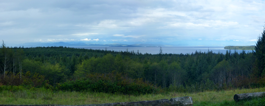
The drive north on Route 19 along the shore and over/through the mountains is extremely scenic. Heavily wooded mountains that reach right down to the sea and up to the sky are a sight to behold, but difficult to capture in photographs as the views are so vast. Click on panoramic below for a slightly better look.
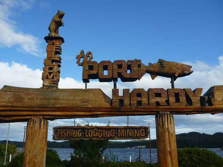
Port Hardy, the region’s largest town, is located at the northern end of the paved highway. This road, which was not completed until the 1970’s, has some history to it, as indicated on this interesting monument in Carrot Park. If you can’t read the inscription here, click on the photo to view it larger. If you still can’t read it, hold your control button and plus symbol down simultaneously to blow it up further. If you don’t know that little trick already, you might find it useful.
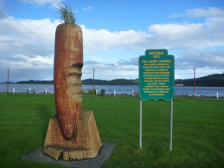
While doing some online research on the Carrot Campaign, I came across the World Carrot Museum (who knew?!) website that (of course) features this monument, including the inscription. Scroll about halfway down their home page to view it.
Not letting the previous night’s roust dampen our enthusiasm for boondocking, we boldly parked right in the Visitor Center parking lot overlooking the bay. While I was preparing dinner, distant sirens drew nearer. Soon a firetruck turned into our parking lot and headed right towards us, turning abruptly off just a few feet from the side of haRVy (really – see photo below!). What could this be about, I wondered!
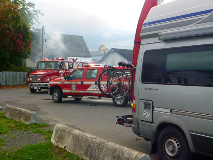
Somehow a small fire had started under the abandoned house right behind us. The whole town, including the police and fire departments, now knew where we intended to camp, but once the fire was extinguished we never saw another official. Seems they are a bit more relaxed about such things up here.
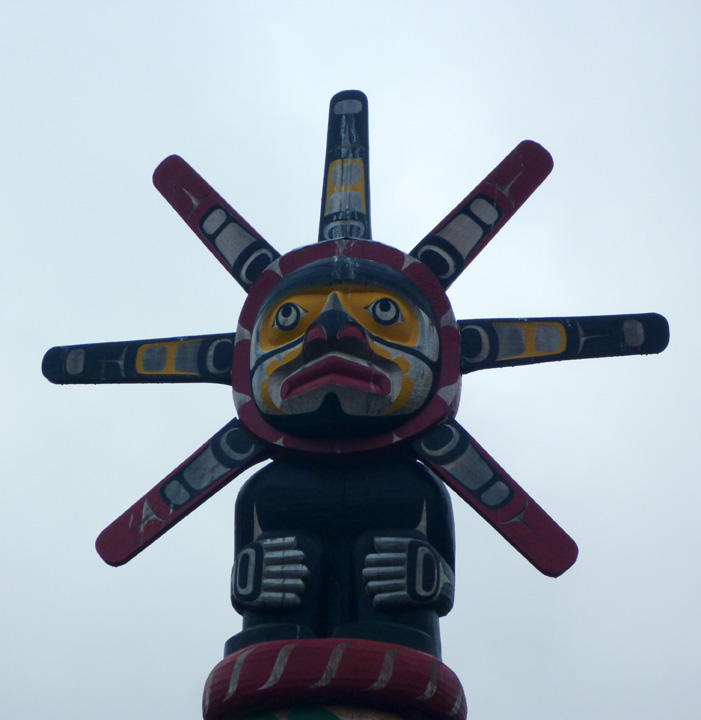
Northern Vancouver Island is loaded with carved wooden signs, totem poles, and monuments. This tradition links to the indigenous First Nation inhabitants of the area. Descendants have proudly taken up the craft (trade?) once again.

The weather was not very cooperative, with quite a lot of wind and rain, but we managed some interesting outings between the worst spells. One was a drive out to historic Fort Rupert, the site of a former Hudson Bay Company fort. The site today is a Kwakwaka’ wakw village where visitors can see native carvers working on totem poles or other artwork and traditional crafts. We only saw one carver working, but we did see a lot of their finished work all around the village, most notably in the cemetery.


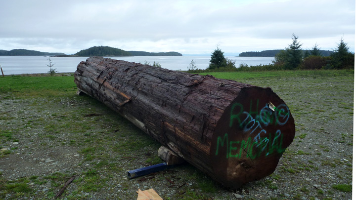
Log earmarked to become a memorial totem pole.
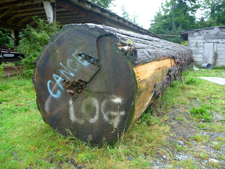
This log is destined to become a carved canoe like the finished one below.
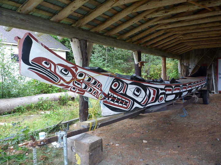
I have learned to love their nature-inspired artwork.
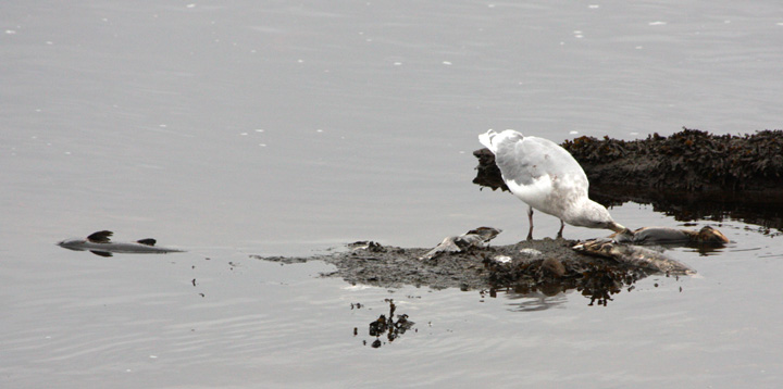
While walking along the estuary, we witnessed an interesting natural phenomena. What do you suppose all these seagulls are so excited about?
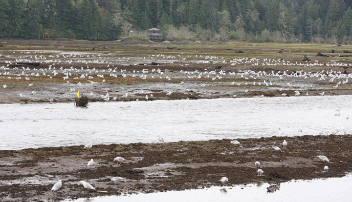
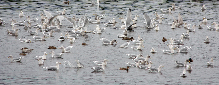
We had not yet been lucky enough to see salmon swimming up river to spawn, but here the dead carcasses were being washed back down the river where the gulls feasted upon them. Not quite the same type of experience… actually almost kind of gross, until you realize that the remains of those fish are feeding many different types of wildlife and even the surrounding soil and flora.
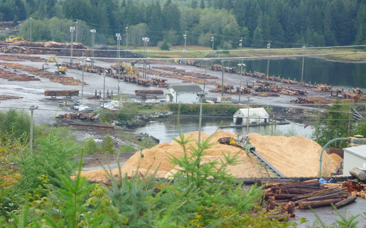
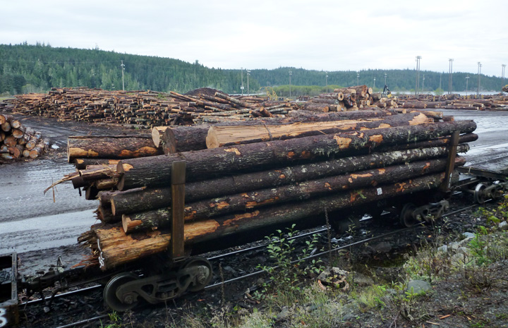
Lumber is BIG business in these parts. Evidence of that fact is everywhere – speeding logging trucks on the roads, clear-cut scars across mountainsides, and log sorting operations in the bays and waterside lots. Even with all that logging activity, it is unbelievable how many mature trees still stand all across this vast island.
A bit further south at Port McNeill we had hoped to take a ferry to Alert Bay on Cormorant Island. The oldest community in North Vancouver Island, the Cormorant Island fishing community was an important trading center for early residents in the area and has been the traditional home of the Namgis First Nation for several thousand years.
We were informed that the usual ferry was not running due to construction work on the new terminal. That meant we could not take haRVy over and camp overnight as planned. We decided we would just do a long day trip over to see the highlights, so we camped nearby and got up at the crack of dawn to board the first ferry. The ticket seller informed us that high winds were expected that would likely cancel afternoon crossings, which would strand us on the island without a place to stay. Seemed clear to us that visiting, Cormorant Island was just not to be at this time, so we headed on down the road to Telegraph Cove instead.
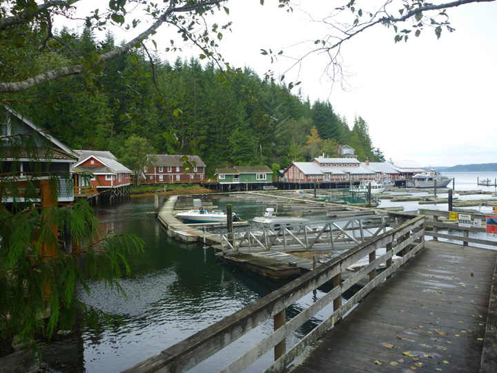
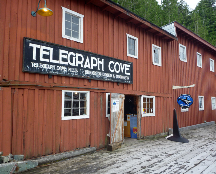
This tiny sawmill and cannery community was important to the development of the North Island and has a rich and colorful history. From 1911 when the first telegraph operator took up residence in Telegraph Cove this little cove has been a unique part of Northern Vancouver Island. The resort, which maintains the boardwalk village in as close to original conditions as possible, was closed for the season, but we were still able to walk around the picturesque site. At the end of the dock we were surprised and happy to find the Whale Interpretive Center open.
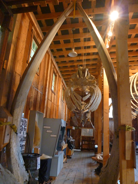
Check out those whale jawbones standing in the foreground!

Our next detour off the main highway as we headed south took us into Sayward. However, the best surprise appeared just past the village at the end of the road. Kelsey Bay, with its quaint 6-space campground overlooking the Inside Passage captured our hearts immediately. We stayed for two nights, but never got to see the place with any sun shining. We just might have to return someday, but I understand that you must book a campsite a year in advance!

Panoramic view from campsite. Click image to view larger.
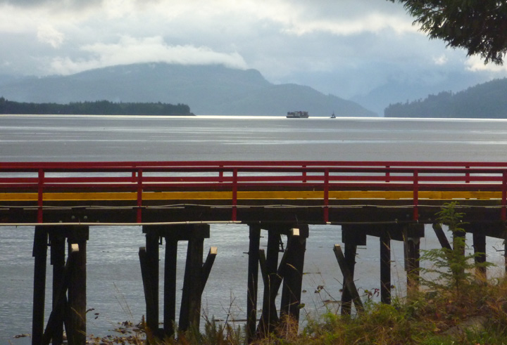
The wharf (above) at Kelsey Bay was once the southern terminus for the B.C. Ferries Inside Passage route until 1978, when Highway 19 was extended north to Port Hardy. It is now a convenient stopping point for sport fishing and eco-tourism. Fresh seafood is reportedly often available from one or more boats tied up at the wharf. We saw none of that activity during our off-season visit.
We are the only campers here during our stay.
No anchor? Just tie the boat to the nearest log.
These tiny little boats are used to sort and move logs.
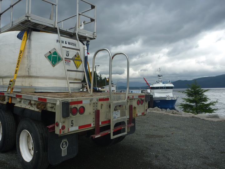
This truck (and a dozen more like it) was off-loading baby Atlantic salmon from an onshore hatchery onto the waiting ship for transport to the offshore farming pens.
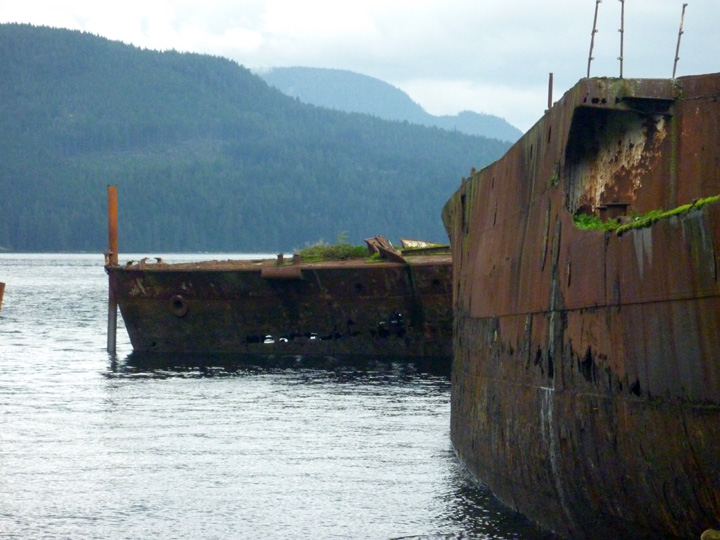
Four old ships were brought here to serve as breakwaters for the log booming grounds and the small boat harbor.

This one, the SS Cardena, served as the flagship of the Union Steamship fleet on the BC coast for three decades.
Safety is no longer provided by these glasses.
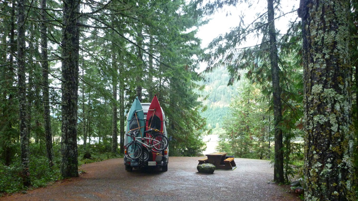
We had a very enjoyable and informative visit to the Museum at Campbell River before driving another beautiful windy road (Route 28) into the interior to visit beautiful Buttle Lake in Strathcona Park. Once again we are the ONLY campers in the campground that has over 75 sites!
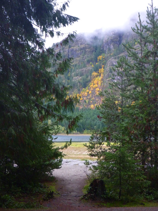
Just a glimpse of the lake from our campsite.
All the sites in the BC Provincial Parks are as pristine and level as this one. America’s National Parks should take note.
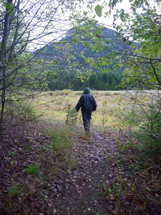
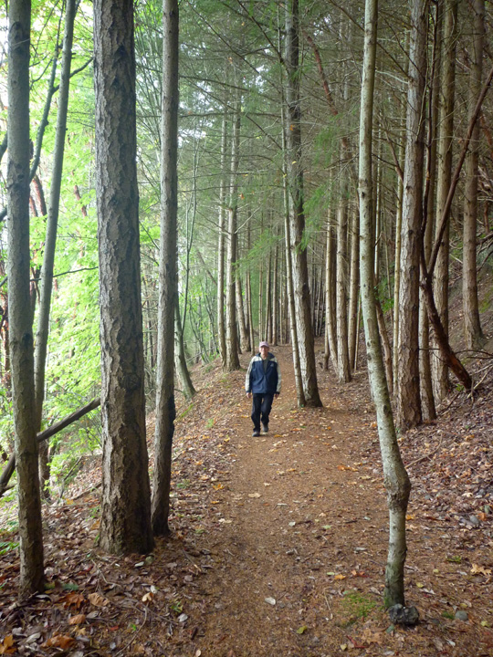
A little hike around the lake between rain storms.

Another obligatory selfie.
Absolutely nobody else around…

Plenty of mushrooms though. Think these are edible?
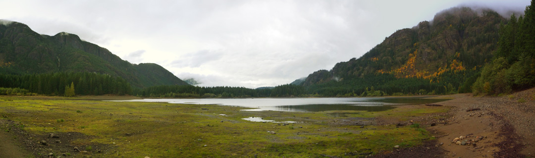
Panoramic of Buttle Lake.
We are now back in Jason and Sunday’s driveway (thanks again guys) in Courtenay waiting out yet another massive rain storm. It looks like we might get a bit of better weather over the next week before we head back to the United States mainland. We are keeping fingers crossed.
Posted in Canada, Vancouver Island
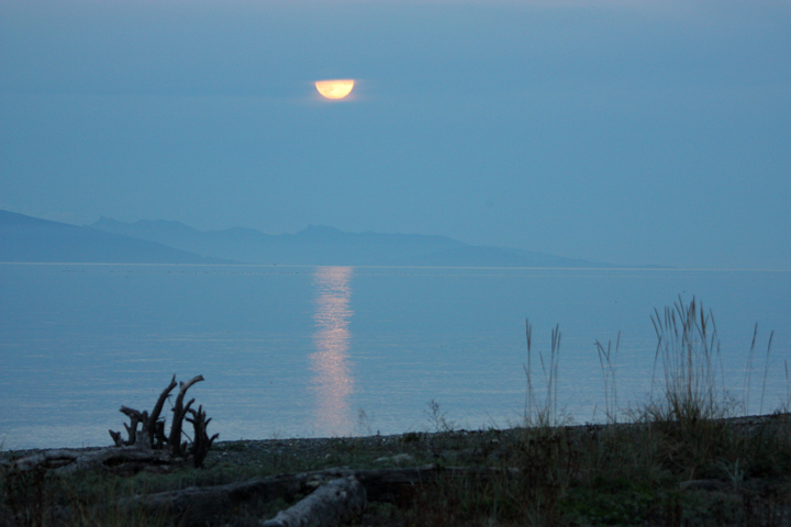
After our boat ride on Barkley Sound we headed back to the east coast of Vancouver Island to beautiful Qualicum Beach. While we were parked beach-side for dinner we got to witness an unusual full moon rise between the clouds over the bay. That is mainland British Columbia across the water.

The next morning we moved down the beach a bit for breakfast and a walk along the shore. The shot above was taken there. The photo I didn’t get was of the Bald Eagle we watched snatch a piece of fish from a flock of gulls…darn it.
We really felt comfortable in the Qualicum Beach community where we spent some time walking around the charming downtown area, accessing free Wi-Fi at the seemingly brand new library, and having a unique lunch at Rawthentic.
A bit further north along the coastal route we boarded a ferry at Buckley Bay, which took us to Denman Island. A quick drive across that island to another ferry and we were off to our destination at the end of the road on Hornby Island – Ford’s Cove Campground.

There is something special about what are referred to locally as “two-ferry islands.” (In our case it actually took three ferry rides to reach Hornby Island, when you count our trip across from Washington State to Vancouver Island.) The additional effort required seems to attract a more interesting sort of visitor and resident. The serenity and scenery are worth it.


This view is back towards the big island from the porch of the general store (below) at Ford’s Cove. We were pleasantly surprised to find many healthy and ethnic food options here plus fresh pizza slices and cappuccinos! I was disappointed that the art gallery, which features work by several local residents, was closed during our stay. They only open on weekends in October, the price we often have to pay for traveling off-season. Oh well, at least I got to window shop.


These campground girls supplied us with farm fresh eggs. Might they be Rhode Island Reds?
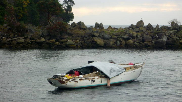
The store and campground overlook a funky marina in which the boats are packed in chock-a-block so most can’t get away even if they want to. I do have to say, however, that I wouldn’t go to sea in many of them anyway. You will see why I say that in the photos below.


Inside the wheel house
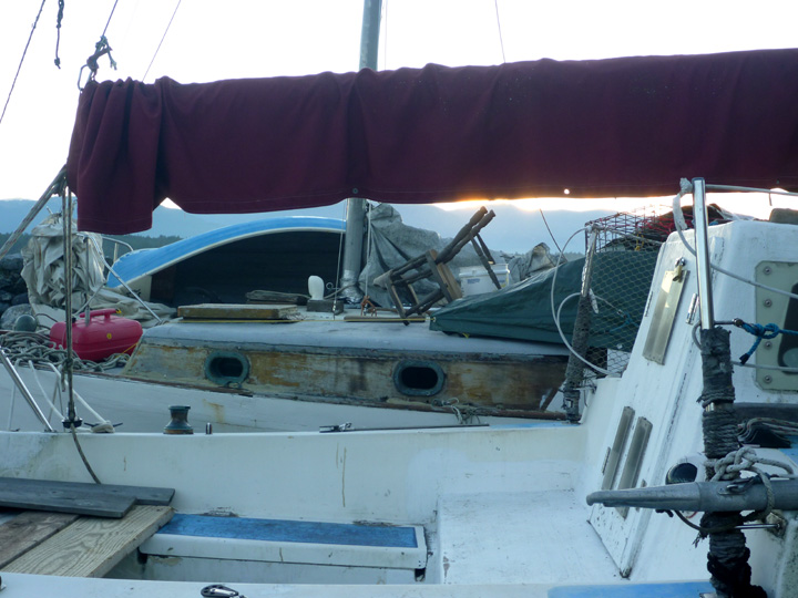
Looking across three decks

Just the necessities onboard…
Doubt these sails have seen the light of day recently.
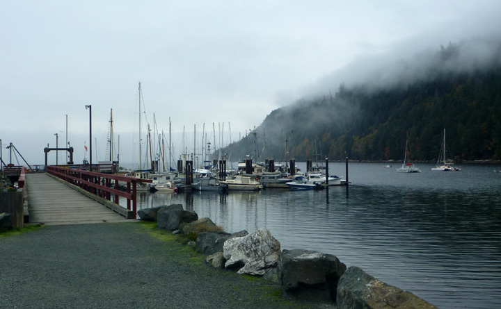
The distant view looks quite nice though.
Signs that there is much more going on here in-season.

As the tide went out some very interesting rock formations were exposed.


We hiked a coastal trail from the campground…

Took a couple of rides around the island to visit a few beaches…


And some interesting neighborhoods…


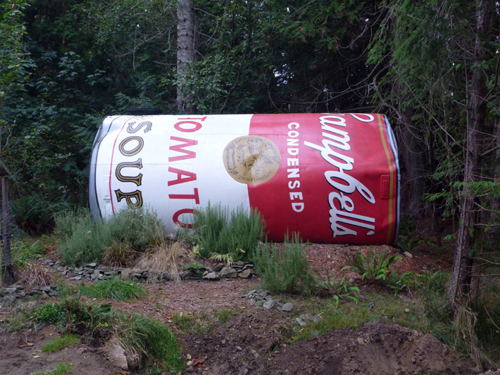
Tanks of water are strategically placed around the island for fire-fighting purposes. Most have been painted by local artists. This one was obviously done as an homage to Andy Warhol.

A rather unique roadside egg stand
On our way back we spent a little more time on Denman Island.

Downtown… food, liquor, gas and mail… what else do you need, right?

Our lunch time view
Home Sweet Home ?!?

A look back at Ford’s Cove.
Once back on Vancouver Island, we drove to Courtenay where we stayed with my brother’s wife’s sister’s son, Jason, who we met briefly seven years ago at my niece’s wedding. He was a bit surprised to get my phone call, but welcomed us warmly. He, his wife Sunday, and son Ishan graciously shared their driveway and washroom facilities with us for two nights. Even better than that – they invited us to share the Canadian Thanksgiving Holiday with them and a group of friends at Al’s chalet at Mt. Washington Alpine Resort.
We wish the weather had been better (rain and fog) during our visit so we could have enjoyed the natural beauty of both areas, but the company and meals were a deeply appreciated treat. Thank you all for sharing your homes and holiday!
Posted in Canada, Vancouver Island
